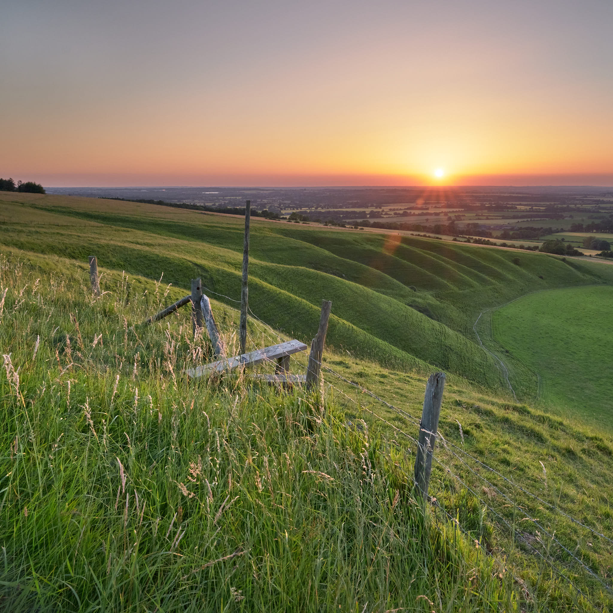
Cornish beaches at sunset can be magical places. As English beaches go, they are instantly recognisable with a beautiful mix of white sand, large colourful shapely boulders interspersed with golden-brown seaweed and, of course, gorgeous aqua-marine blue waters. Who couldn’t love that!
Of course not all Cornish beaches are so great but there are some real gems especially away from the the larger holiday beaches. The small rocky coves of the North coast can be especially great in the evening.
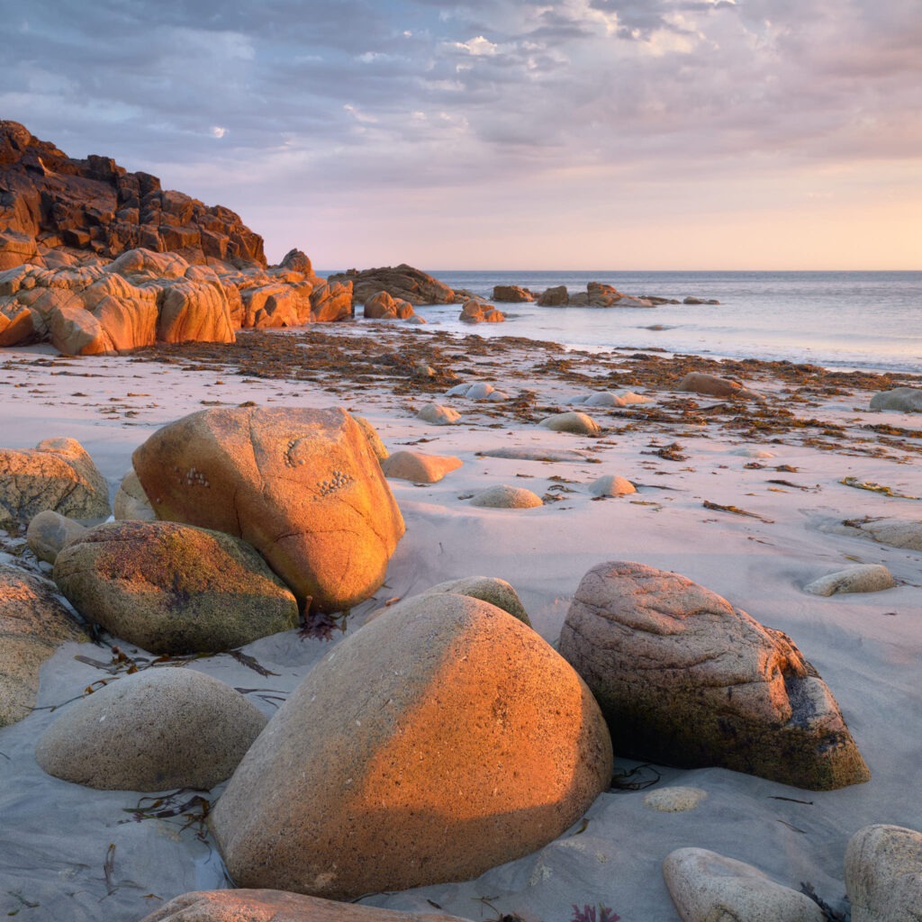
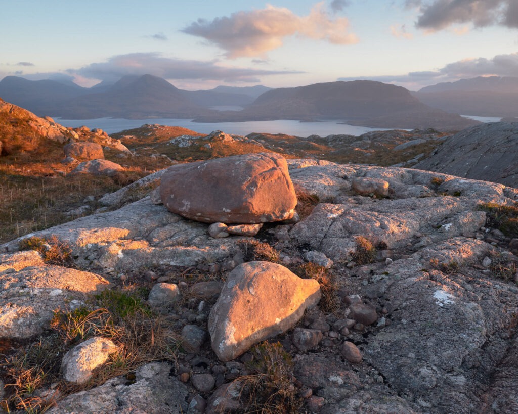
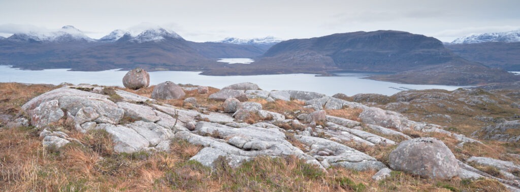
The image above was made earlier this week at Porth Nanven, a great little cove I’ve visited several times before and one which usually does not disappoint. On this occasion the tide was retreating removing all foot/paw prints from the sand and the sun popped out below some high-cloud thirty minutes before hitting the distant horizon. The result, a swath of lovely colourful, soft, low-angled light illuminating the rocks on the beach.
I’d got there early, a little too early, a short time after high tide and whilst the beach was still under water hoping the slow-moving clouds would not get in the way and that the tide would retreat sufficiently to access to beach. In that time I met a couple from Penzance by their van, chatted away the hour or so and was repeatedly told to have confidence as it was going to turn out great. It did too! So many thanks to those two lovely people, you were excellent company and made for a memorable end to the day.
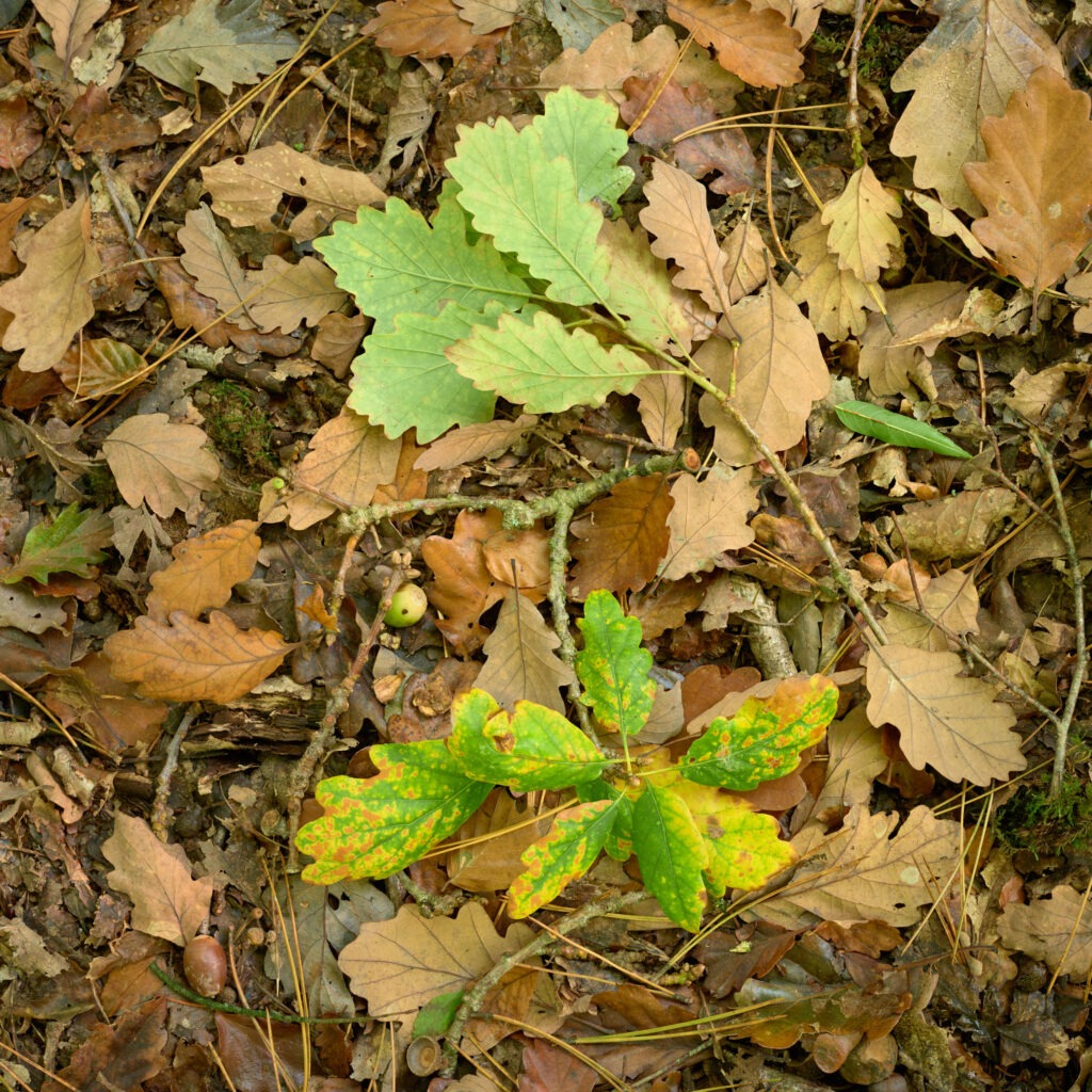
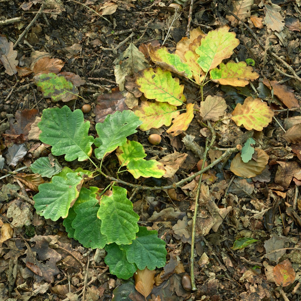
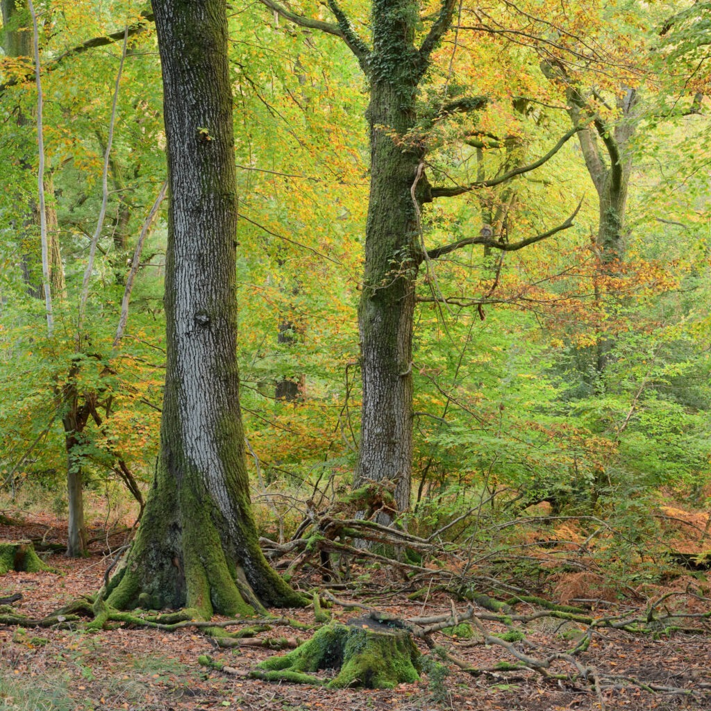
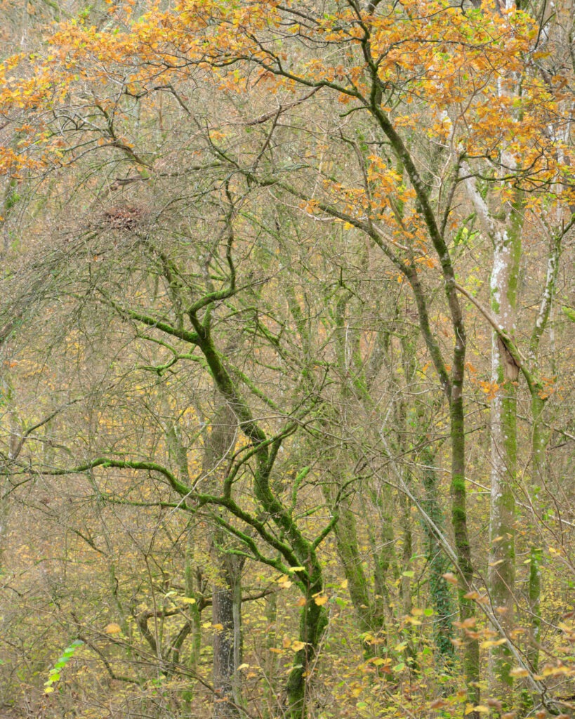
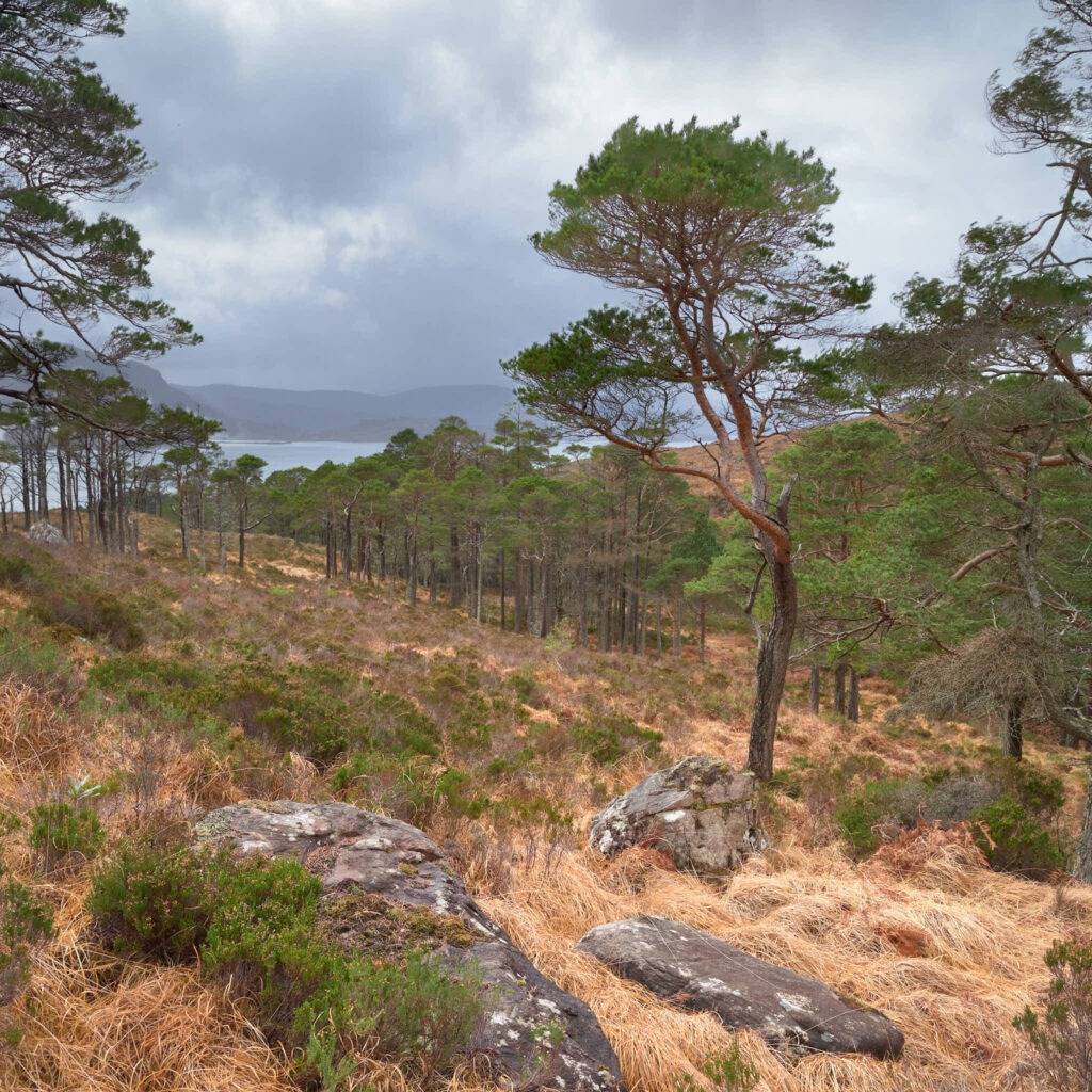
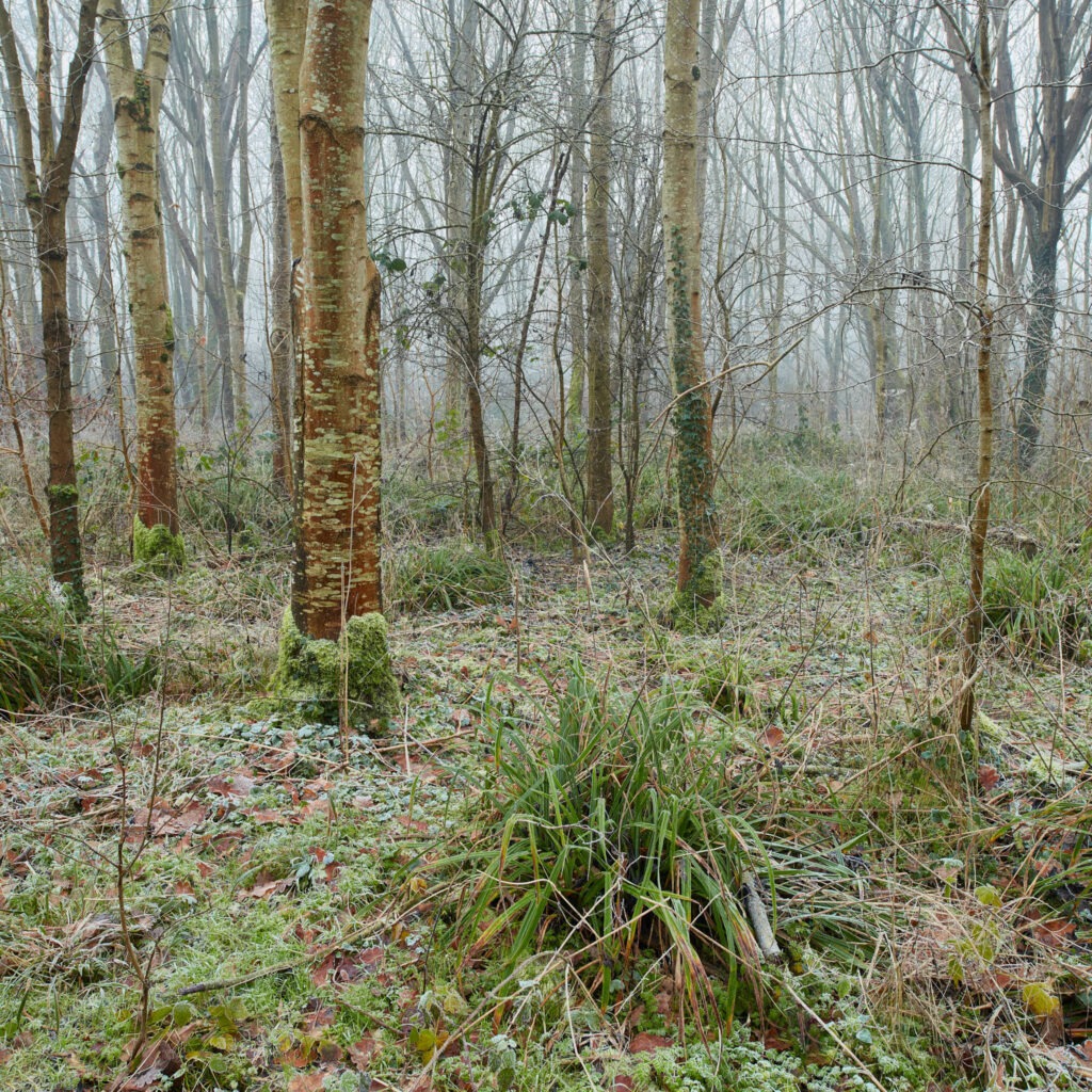
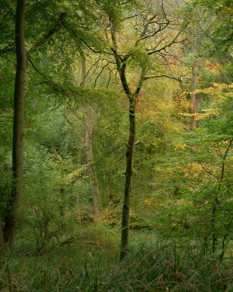
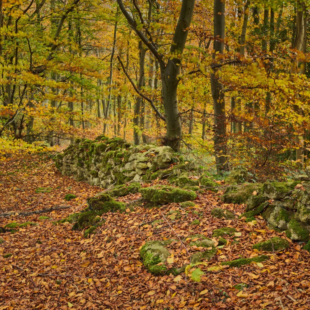
Here in the UK South West the trees started to turn in early October but there was really no noticeable mass change until the second week of November and after a few chilly nights and windy days. Afterwards the rate at which leaves changed from green through yellow, gold to brown seemed to increase and by the fourth week of November, Autumn was pretty much over. This change is clearly noticeable in the photographs I’ve chosen to include with this post. Those made first, fallen leaves on the ground, were made on 15th October and the last, named “Burnt Wood No. 1” – located near the town of Wickwar further to the East – on 22 November.
This year I chose to concentrate mainly on my local forest – The Forest of Dean – rather than flit around too much between different locations. For those not familiar with the forest, Forestry England describe it as “…a historic forest with its origins as a royal forest pre-dating the Norman Conquest of 1066. The Forest has been historically isolated and bypassed, sitting as it does between the Rivers Severn and Wye on the border of England and Wales.”. It is a working forest and, as such, consists mostly of younger, straight trees be those evergreens or deciduous. The deciduous trees clearly make for more colourful Autumn photography and are primarily Beech with a little Oak, Sweet Chestnut, Ash and Birch.
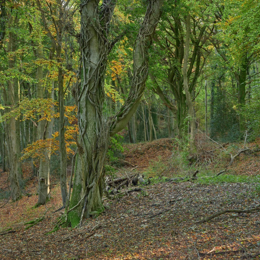
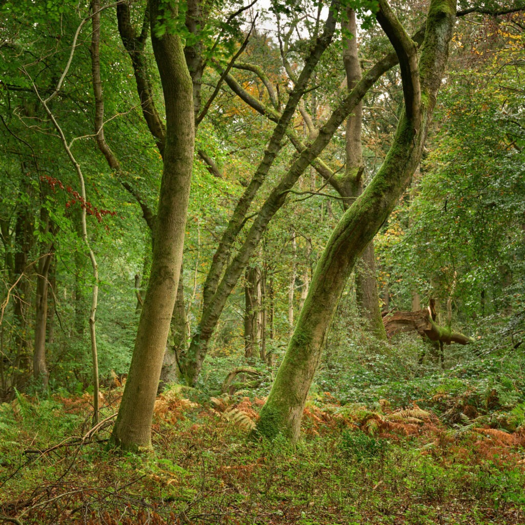
Writing this, I find myself again asking why I enjoy being in woodland and why I enjoy making woodland photographs. It’s a very hard question to answer as it’s more ‘feeling’ than something easily placed into words. I do know however, that I find woodland relaxing, calming and peaceful. There is something about the enveloping sounds, colours and life-stories. It often feels like the passing of time slows and with it an awareness of surrounding increases. Move slowly and quietly and after just a short while it’s as if the forest accepts a visitor and carries on around you. Stood still, making a photograph you notice the rustling of leaves as air moves through the trees; squirrels frenetically preparing for an approaching Winter, birds moving in the trees even beatles, ants and other small bugs crawling around on the forest floor. Occasionally deer will appear through the trees, stood still and watching, before bounding away. I’ve yet to see the boar but evidence in the form of disturbed ground is all around. The place is alive! Compelling too is the idea that a forest is a record of time, of the past, present and the future. The forest floor is the canvas on which time is recorded. It is layered with tree stumps, fallen/broken branches, leaves of Autumn’s past and saplings which in-time will become trees.
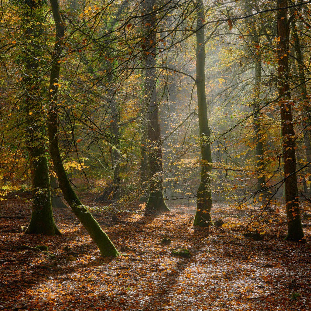
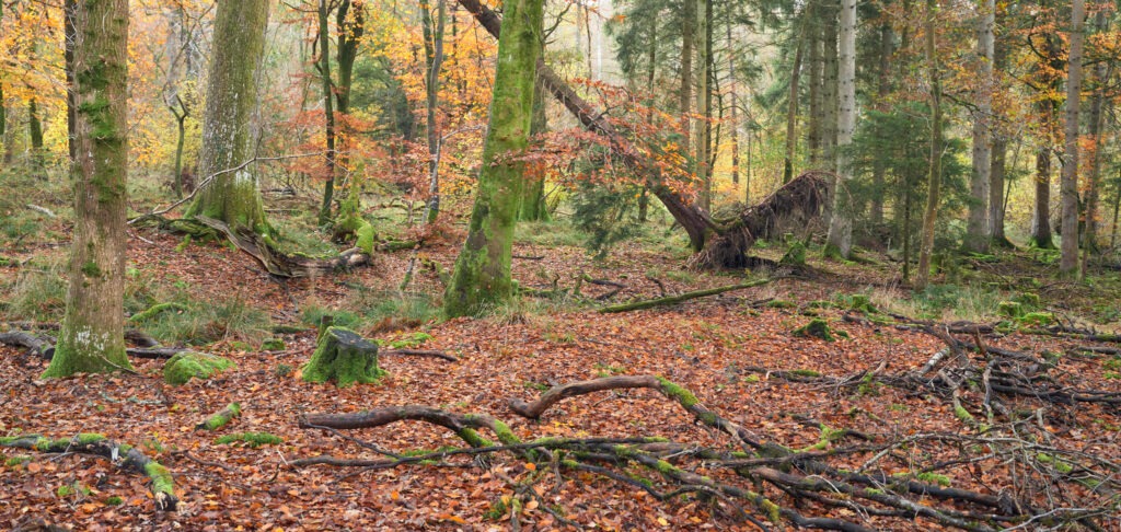
From a photography perspective woodland, including forests, are chaotic, hard to photograph places. The techniques required are common to photography generally, especially Landscape, but I believe observation especially important as it’s foundational to identifying compositions in messy woodland environments. Given messy environments, simplification usually leads to better results. Sometimes finding simplification means looking down, as in leaves on the ground, or finding contrasts in shape, light or texture – ‘Burnt Wood No. 1’.
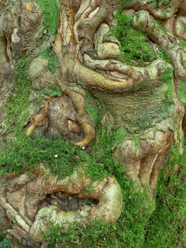
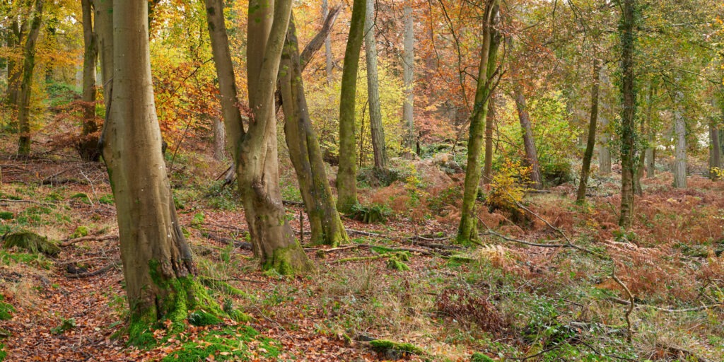
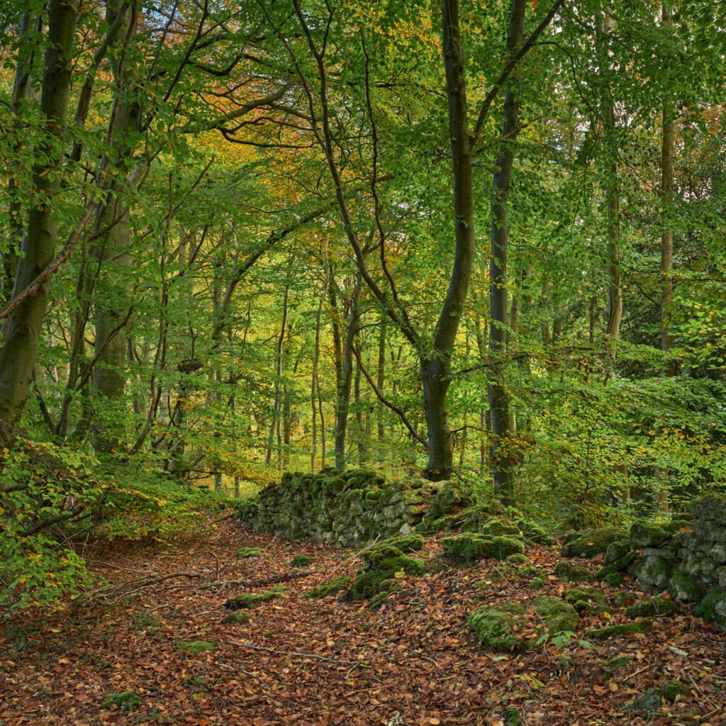
‘Beechenhurst Inclosure No. 3’ is one of my favourites from this Autumn. It was made early in the season so everything is still quite green but I feel it encapsulates that feeling of ‘forest’ discussed above. It includes the messiness in a controlled way and the life-story of old and new in the forest. Next Autumn it may look quite different with further new growth and decay. It will be interesting to return. I feel I must mention ‘Face in the Tree’ as it was a total surprise and lucky find; It was also huge fun making the photograph! Whilst slowly walking through the forest looking for compositions I spotted what immediately stuck me as a face low down on a trunk. It struck me as so realistic that I actually checked someone hadn’t done it on purpose! It certainly showed no signs of being nothing more than natural in origin. The eyes, nose, mouth and cheek bone were so clear!
In early 2017 after a week in Lofoten with Tom Mackie I was poring over Ordnance Survey maps of the English, South West coastline seeking potential locations for coastal photography. I spotted Hartland Quay; Situated on the coast with a hotel and a campsite not too far inland it appeared to have potential as a photographic location. After some online research I decided it was worth exploring and so chose to stay at the hotel in March of that year for a couple of days. Whilst I recall the weather not being great with wind rattling aging sash hotel windows, I do recall being captivated by the sea cliffs and the rocky/sandy beaches. Back then, Hartland Quay got recorded in my log as a place with potential and worth revisiting.
It was in late summer this year that I returned for a weekend with friends and was reminded of its potential and my earlier log entry. So, after some further research including the selection of a week compatible with tide heights/times I returned in October this year, choosing to stay at the near-by Stoke Barton campsite for a week.
Top-tip. I highly recommend keeping a log; It’s somewhere to record ideas and places that peek interest. Once recorded, entries are not forgotten and what’s more they can be researched, developed and then associated information recorded for future use. Information such as when is the best time to visit? Is the location best at high tide, at low tide or what height tide is desired for a photograph? Keeping a paper log is an approach and may be appropriate for some but I propose paper is less durable, less portable and would get messy very quickly as ideas are researched and information revised. My log is electronic. Just recently it moved from an application called Evernote to Apple Notes due to concerns about the stability of the company behind Evernote. But the application is actually not that important as such note taking applications are available for all mainstream compute platforms be it Windows, Mac, Linux, Apple IOS, Android etc. Electronic form is very portable, doesn’t get messy – if maintained – and can be content rich. For example, my note about Hartland Quay includes contact information and web links for the hotel, the campsite, text and thumbnail images about possible photographs, text identifying at what tide height exit across the beach is cut-off etc. In electronic form it’s possible to always carry the log so if your plans change whilst on location you stand a good chance of having the information needed.
Earth’s Forces Unveiled
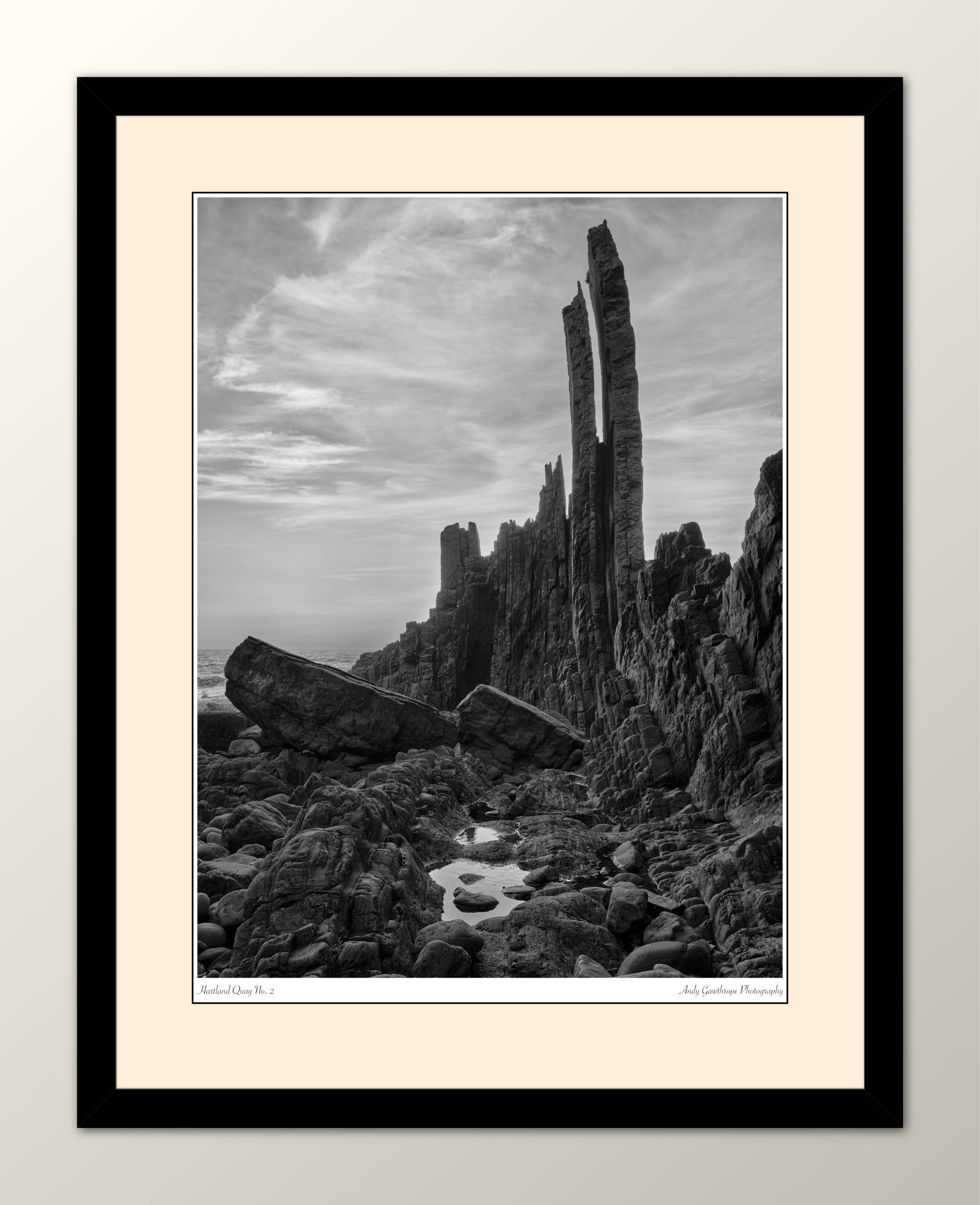
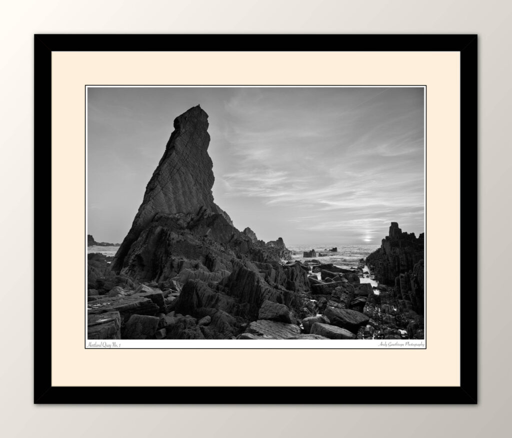
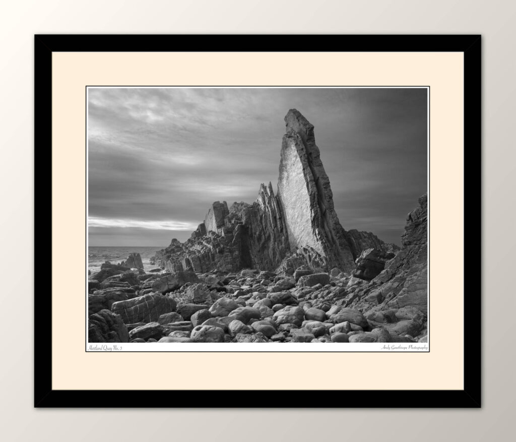
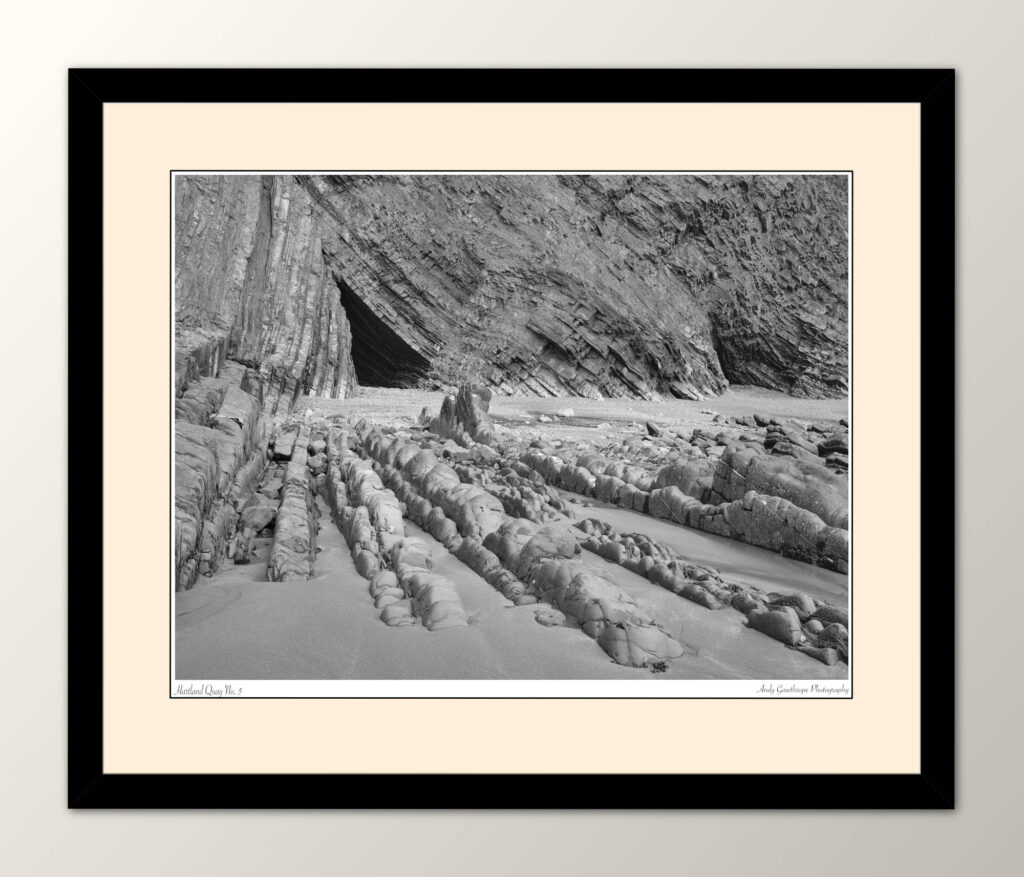
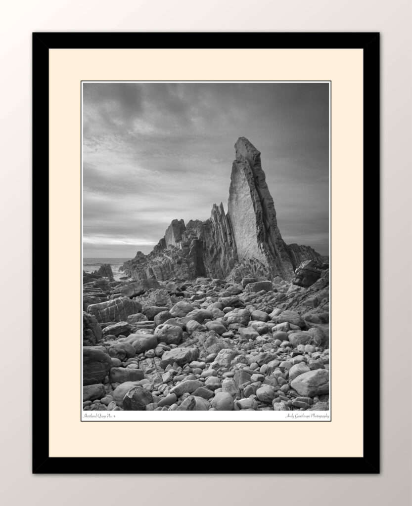
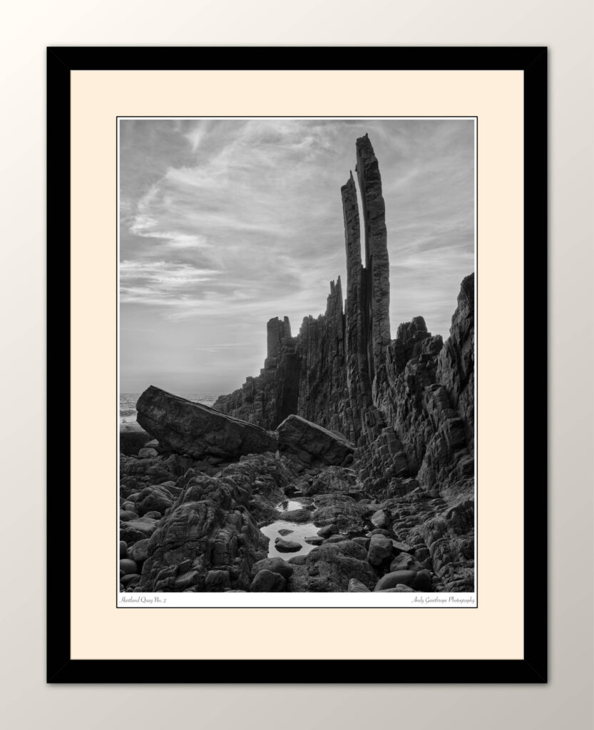
At Hartland Quay and the surrounding area it’s the sea cliffs and their eroded remains protruding from the sandy beach like the skeletons of long dead leviathan’s that I find most interesting. I’m no geologist but the rocks are truly impressive. They were laid-down as sediments in a shallow tropical sea, rich in marine life during the geological Carboniferous period and have been compressed and transformed into alternating layers of sandstone, shale and limestone during the intervening millennia. Today they are not just the edge between the North Atlantic Ocean and the Devon countryside but are a story of geological forces etched into the very fabric of the landscape. I find the dramatic cliffs and skeleton-like rocks a captivating photographic subject as it’s possible to make photographs that freeze moments in time and capture the essence of a place where the past and the present coalesce.
Shipwrecks and Trade
While the geology of Hartland Quay provides a geological narrative spanning eons, the human history is equally compelling. The harbour was initially constructed in the 16th century in the reign of Henry VIII and the pier/quay followed some time later. The harbour has now gone with the pier succumbing to the North Atlantic Ocean in 1887. The anchorage provided by the rocky cove made Hartland Quay a strategic location for maritime trade and the transportation of goods. During its heyday Hartland Quay bustled with activity. Cargo vessels laden with goods ranging from slate to grain anchored in the sheltered harbour waters, ready to unload their precious cargo. The quay facilitated the export of local products and the import of essential goods, becoming a vital hub for the economic life of the region.
However, the unforgiving nature of the North Atlantic took its toll on many vessels attempting to navigate the treacherous waters. The coastline on which Hartland Quay sits became notorious for shipwrecks, with the remnants of stranded vessels becoming a haunting reminder of the challenges faced by mariners. The area is dotted with wrecks each telling a story of perilous journeys and the indomitable power of the sea. A recent shipwreck associated with this part of the Devon coastline is that of the Johanna, a Panamanian-flagged Dutch coaster that ran aground a little to the North at Hartland Point at the end of 1982. Although now almost completely gone, some remnants can still be seen at low tide.
The Wrecker’s Retreat
Clearly I’m not the first stills photographer to have discovered Hartland Quay; It’s also been used as a movie location several times. This is evidenced by a visit to the hotel bar, “The Wrecker’s Retreat”, whose walls are adorned with photographs of the rocks, of the quay and of the many wrecked ships. A visit is well worthwhile to see what others have done and thus what to avoid and to see the historic photographs of the quay and wrecked ships as they form a historical record capturing moments in time. I feel that landscape photographs are important too as the coast is a dynamic environment changing a little every day as erosion takes its toll.
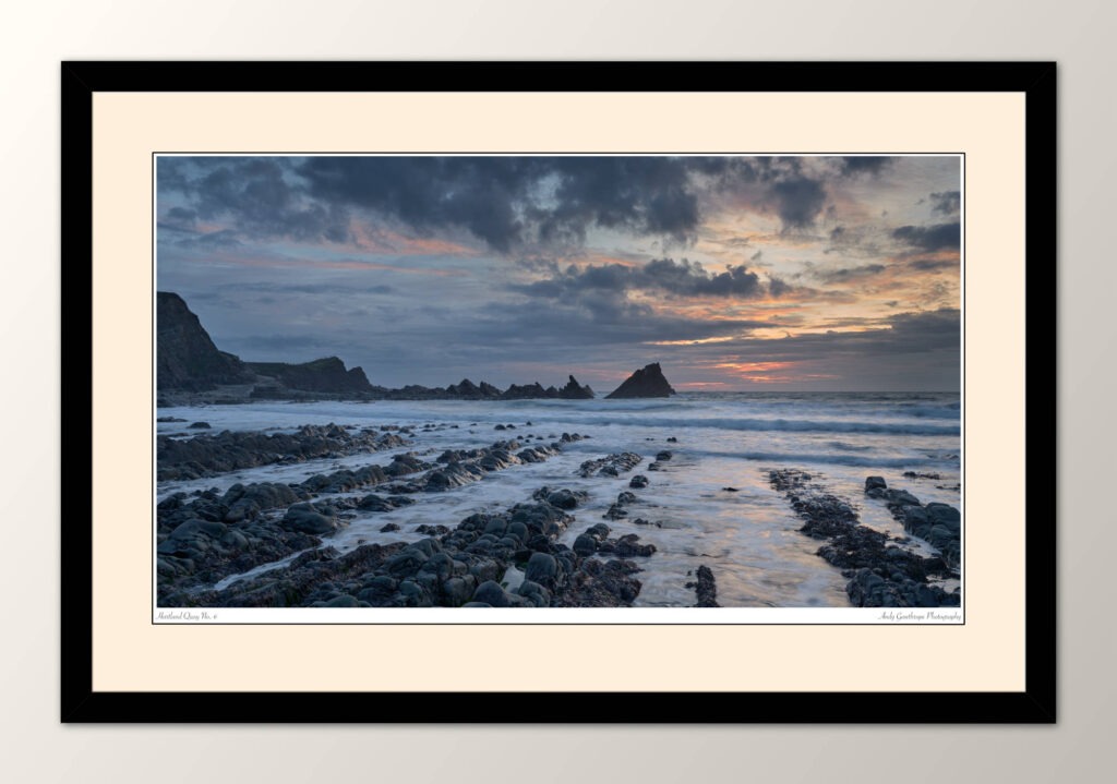
Hartland Quay No. 6
Tides, Safety and Dynamic Conditions
Photographing around Hartland Quay comes with challenges common to coastal photography, primarily the dynamic conditions of a coastal environment. Tide height is pivotal, not only does it dictate the visible elements of a photograph but it also constrains access to the beach/coast. It’s important to know whether the tide is heading out or coming in and at what tide height the lowest part of your access route becomes cut-off. This is especially important on a rising tide when it’s not possible to see your entire access route which can be the case at Hartland Quay. Don’t rely on finding a way up the cliffs either, they are high and constituted of loose/crumbly rock and grasses. Something I’ve seen many times on beaches and which, quite frankly, scares me silly is people sunbathing, sitting, playing etc right at the bottom of sea cliffs with seamless disregard to the tons of loose rocks immediately above them. Even a single, small rock is going to cause injury. So please be careful.
The unpredictable weather of the Atlantic adds an element of spontaneity to photography sessions. During my week at Hartland Quay the weather had many characteristics; some days were cloudless with strong late-summer sunshine, other days were cloudy and one day very, very foggy! So foggy that you couldn’t see more than 5-6m! That fog was too dense to be photographically useful and when it did clear in the late afternoon it revealed cloudless skies. Fortunately the sea was never stormy but there was usually an onshore wind which drove spray towards the beach/rocks and was a constant source of work as the exposed front-surface of lenses or filters were quickly covered in a briny layer which constantly needed to be removed. This leads to some more of my top coastal photography tips:
1. Carry plenty and probably more than at first seems reasonable, lens cleaning cloths / liquids. Once cloths are contaminated with, even a small amount of, sea spray they just smudge and smear. I carry several large micro-fibre cloths but primarily many single use lens wipes. These are small and lightweight so it’s easy to pack many and on use each is uncontaminated by spray.
2. Keep you camera bag close and if a rucksack then preferably on your back. If its on the ground ensure it can’t be reached by that errant higher wave…
3. Keep your camera bag closed so spray doesn’t get inside an onto your equipment
4. Check and if necessary, clean your lens prior to every exposure.
5. Clean all gear at the end of the day or as soon afterwards as possible.
A Visual Symphony of Earth and Time
Photographing the geology of Hartland Quay is a journey into time and something which I greatly enjoyed. The sculpted cliffs and the dynamic conditions converge to capture the essence of a place where the Earth’s history is etched into every rock. It’s a place that has huge potential and to which I’m sure I’ll return.
Andy
All images are copyright Andy Gawthrope Photography.
The long, often blue sky days of summer are a photographically challenging time but this year I wanted to make the most of them by doing something different and pushing my photography into an area not previously explored. My photographs are typically of the classic landscape / grand vista style and include land, sky and if possible, water. I needed a project concentrating on much smaller, simpler subjects that would, hopefully, lend themselves to summer conditions.
Please see the gallery at the bottom of this post for the full collection of photographs. Each may be enlarged by its selection.
After much deliberation two ideas remained. The use of colour, patterns, shapes and textures as a primary subject with images bias towards simplicity and the second idea was to photograph people rock climbing. I like the idea of photographing people in seemingly gravity defying positions high above the ground surrounded by hard unforgiving rock. There is a certain sense of tension and of drama.
At some point I realised that photographing climbers was going to be hard, very hard in fact, despite having over a decade of climbing experience myself but the idea of rock somehow stuck and fused with the first idea. So I had a project, but where to go?
Location
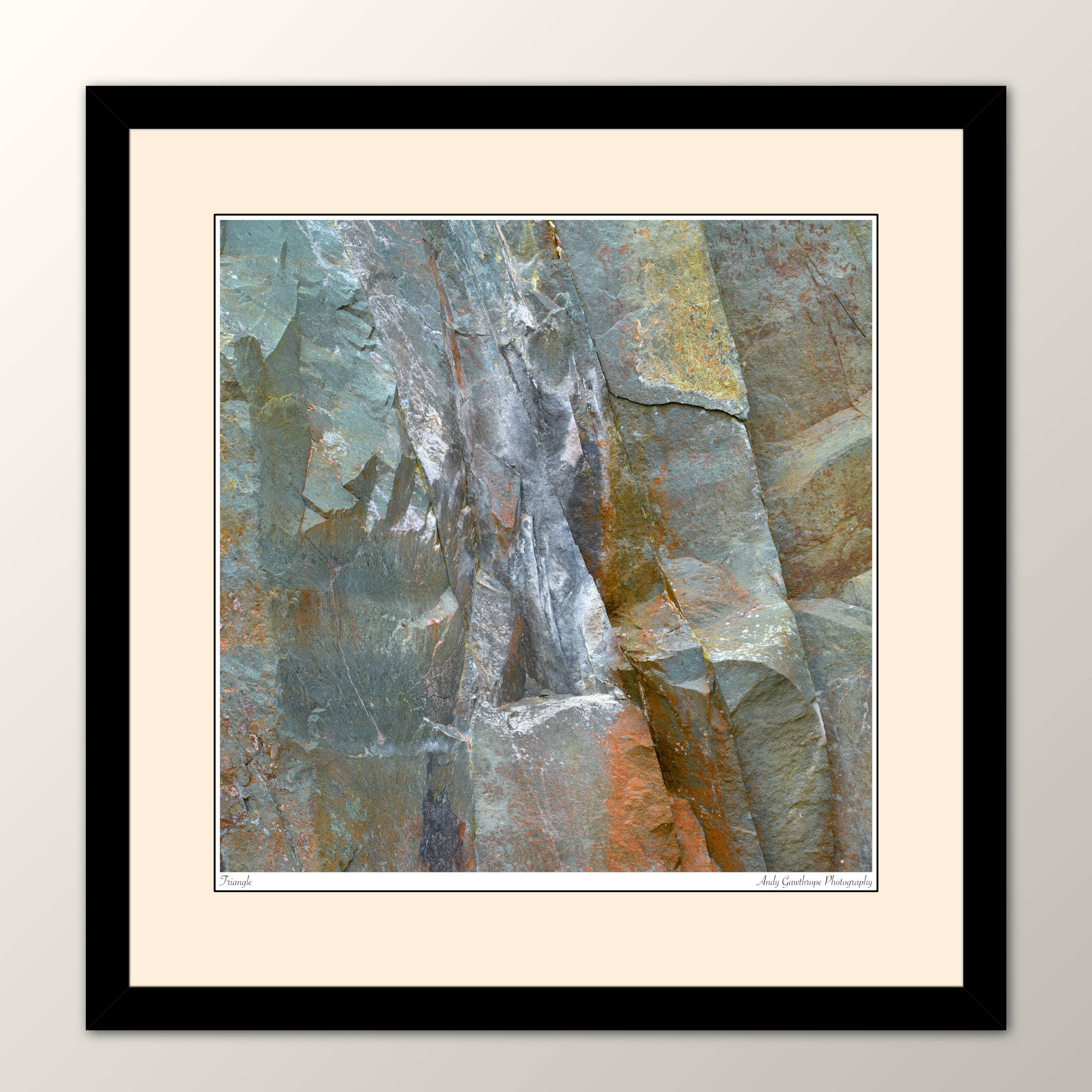
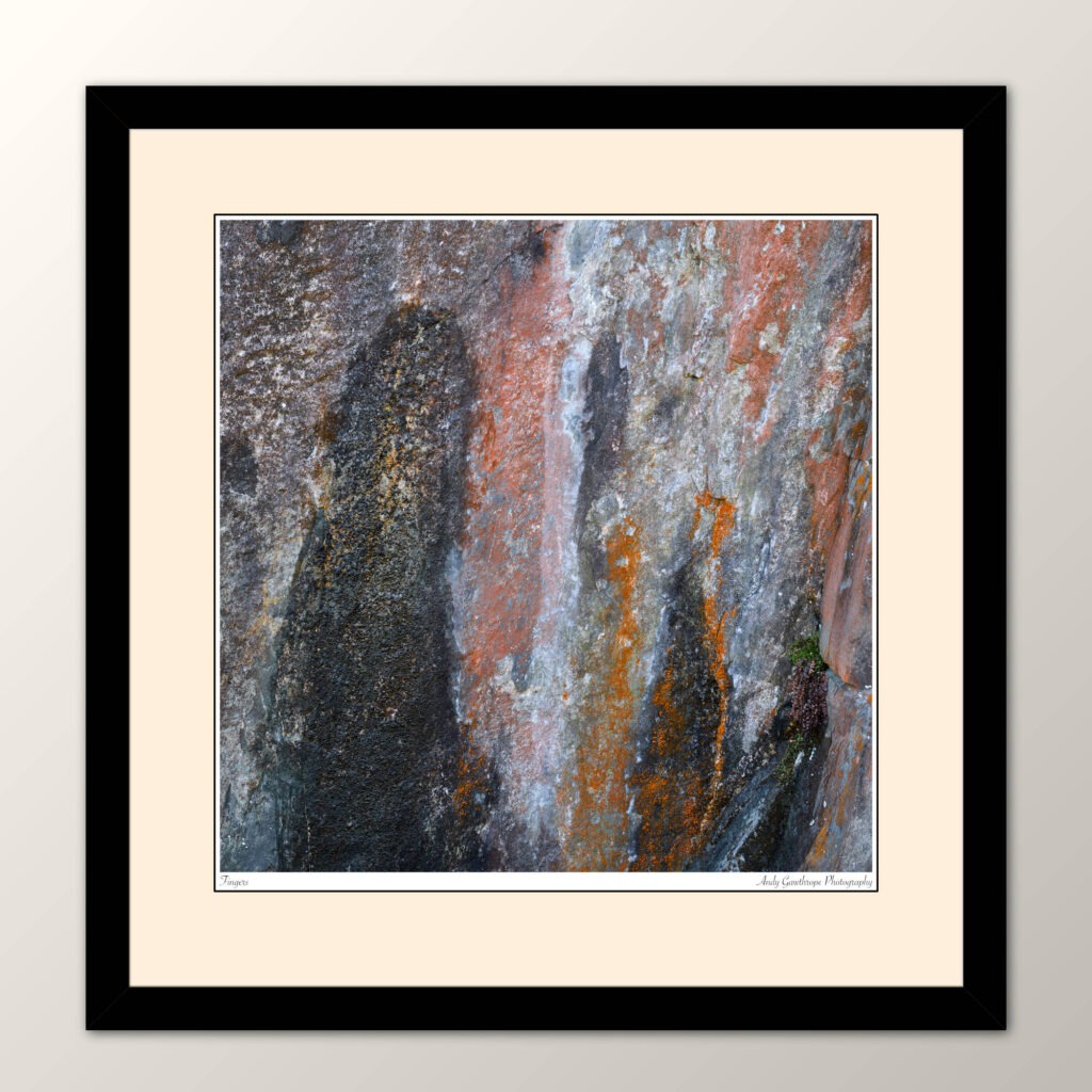
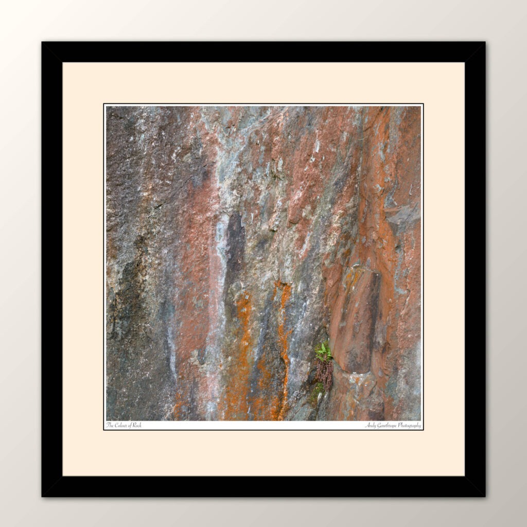
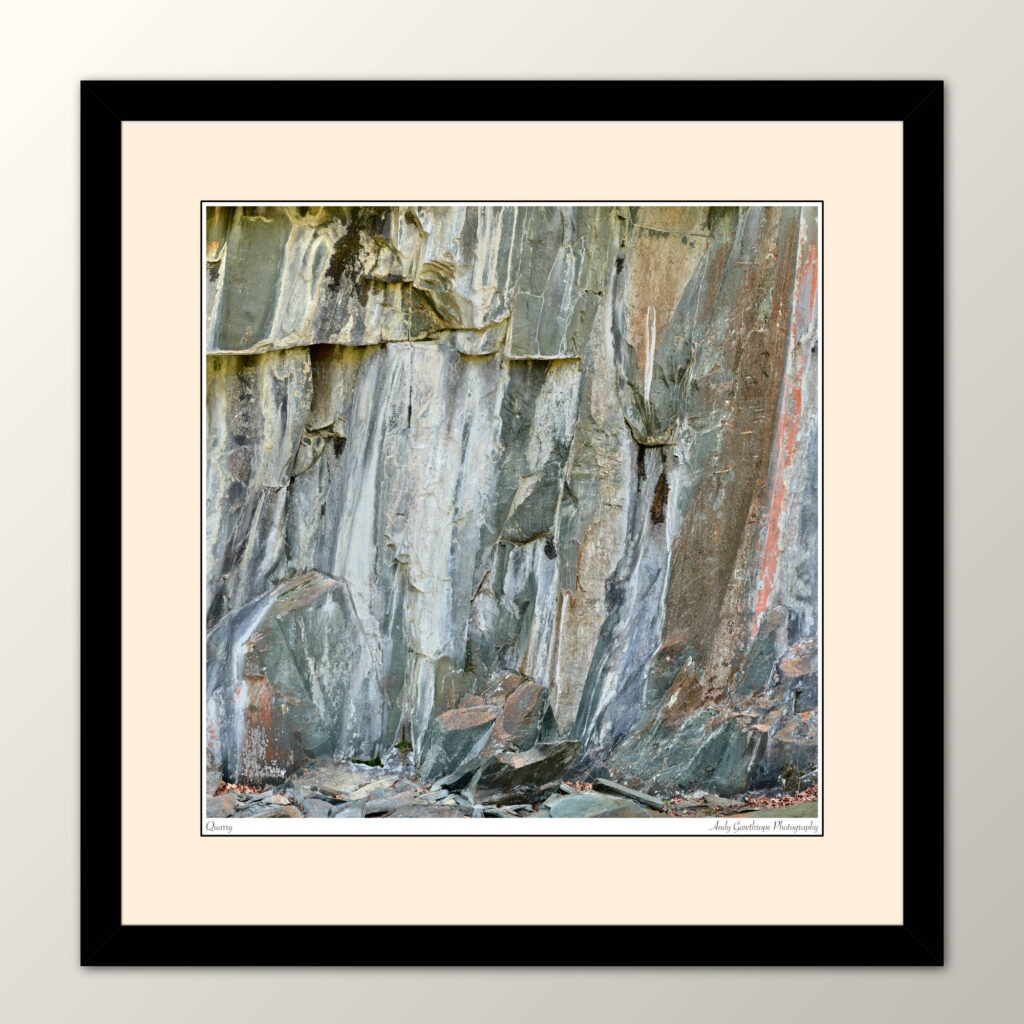
The English Lake District has a long history of rock climbing but also of quarrying for stone. That is no different from many other areas of the UK such as Snowdonia but I hadn’t been to the ‘lakes’ for a few years and felt it was time for another visit. Borrowdale is my favourite Lake District valley. It’s a wide crescent shape with Keswick at the top and Seatoller at the bottom. It’s green and a beautiful mix of small farms, trees and water surrounded by hills and sheep. And, of course, no description of Borrowdale can omit the magnificent Castle Crag which sits in the middle of the valley just below the Southern end of Derwent water. Seen from the North its imposing shape can’t be mistaken. Borrowdale also makes a great location as it has the friendly campsite of Hollows Farm at Grange. This nestles just below the Northern slopes of Castle Crag and thus most locations are within walking distance. It was, therefore, the easy choice as I knew the area had several quarries from previous climbing and photography trips.
Fingers
I must stress that it’s necessary to be very, very careful when photographing in quarries. Rocks can and do fall from above unexpectedly; They don’t have to be large to cause serious injury to body or equipment. They are dislodged by many factors not just humans.
Before visiting, rooting through the Internet and my book collection identified that others had photographed in some of the area’s I was considering before. But the English Lake District is one of the most popular destinations in the UK and it’s almost impossible to photograph something completely original. In particular I was inspired by photographs in Landscape of the imagination by Angie and David Unsworth, ISBN 978-0-9565798-0-5, Greenburn Publishing 2010. Sadly, this excellent collection of work appears to be now out of print.
Equipment
The equipment used for the project was the medium format GFX100s from Fujifilm with either a GF32-64mm, GF45-100mm or GF100-200mm lens and it was usually necessary to work close-up to subjects using longer focal lengths to fill the frame. Focus, sharpness and depth of field were paramount so many of the images were made using wider apertures for later focus-stacking. The Fujinon lenses are very sharp especially at F8 but diffraction does start to soften from somewhere between F11 and F14 and is definitely noticeable by F16. For all photographs the camera was tripod mounted to ensure sharpness but positioning was often complicated as the ground was strewn with boulders and slippery, damp vegetation.
Photography
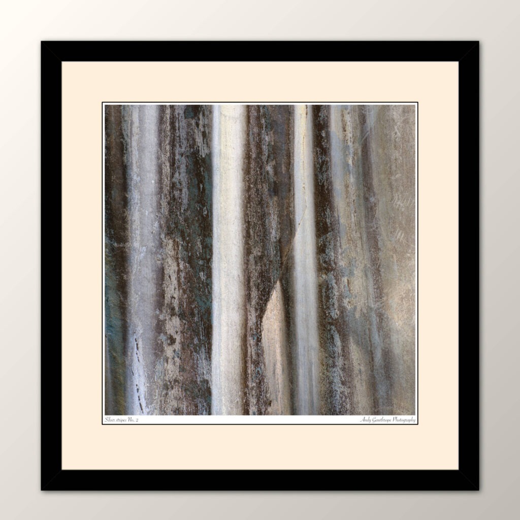
Silver stripes No. 2
Typically my photographs are made to stand alone being intended for wall display either in a domestic or commercial environment. I felt from the outset that the photographs intended for this project would probably work best as a collection and should therefore share, for the most part, a common aspect ratio. The GFX100s has a native 4:3 aspect ratio but in the field I often found myself using the 1:1 (square) preview so it wasn’t a surprise that on returning that I quickly settled on a 1:1 aspect ratio for all photographs.
I was fortunate that on each visit to the Lakes the weather was dry and bright, perhaps sometimes a little too bright but at least not dull and wet. Overcast but bright days were best, deep shadows were avoided and there remained sufficient, softer light to bring-out the colours. Although clear-sky days or days with direct light gave well saturated colours and shorter exposures there was also a tendency for shadows from surrounding trees and their leaves to be deeper and more noticeable. When these shadows moved between images focus-stacking became problematic and required extra work to ensue specific area’s were selected from one image over that in another. The best tool I’ve found for focus stacking is Helicon Focus because of the manual interventions and editing it supports during the stacking process.
Whilst making the photographs but more so after returning I became aware that there were two clear groupings; The close-up, abstract ones and those including features more identifiable such as the ground or grasses and thus non-abstract. Initially this was a concern as I couldn’t decide whether I liked the unbalance, the contradiction within the same collection. However, ultimately I feel more comfortable with both being together as they contrast and the non-abstract photographs help set the context of the others.
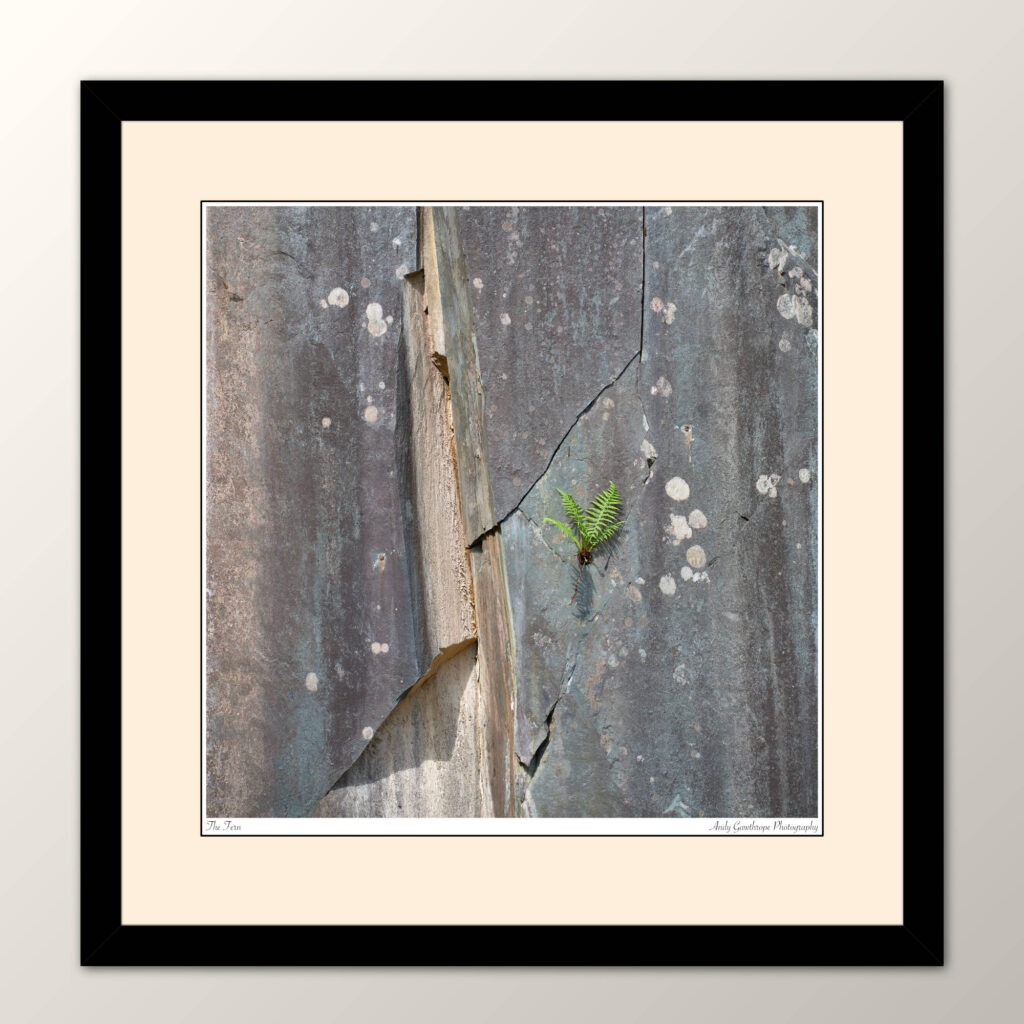
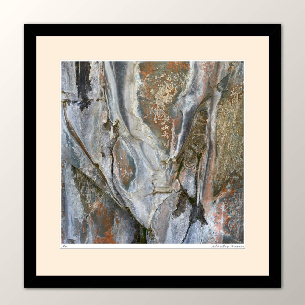
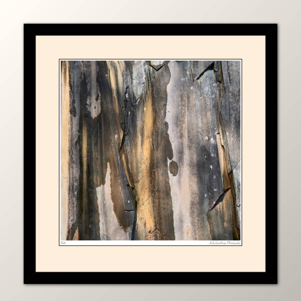
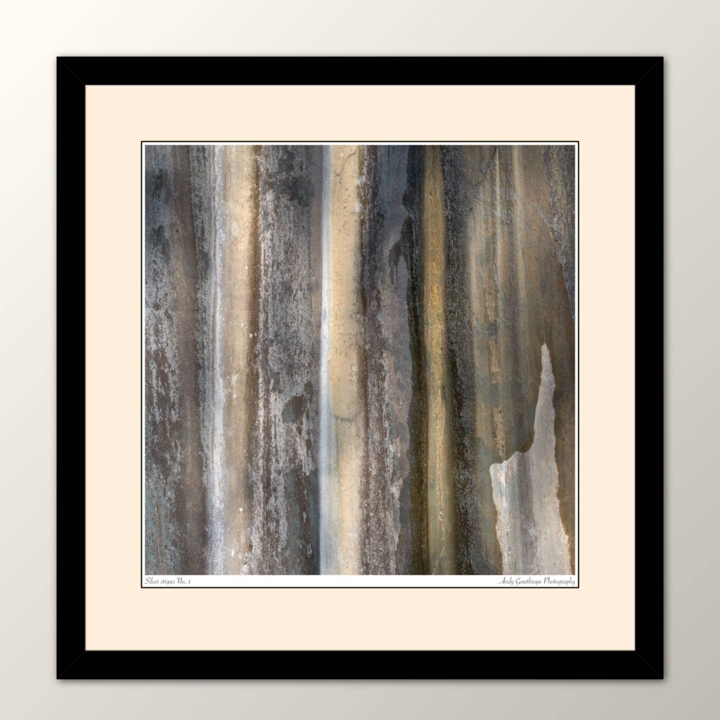
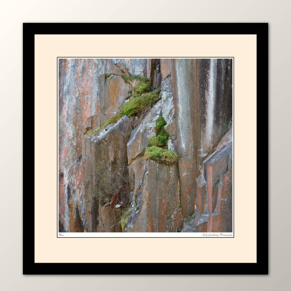
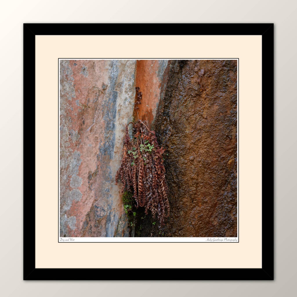
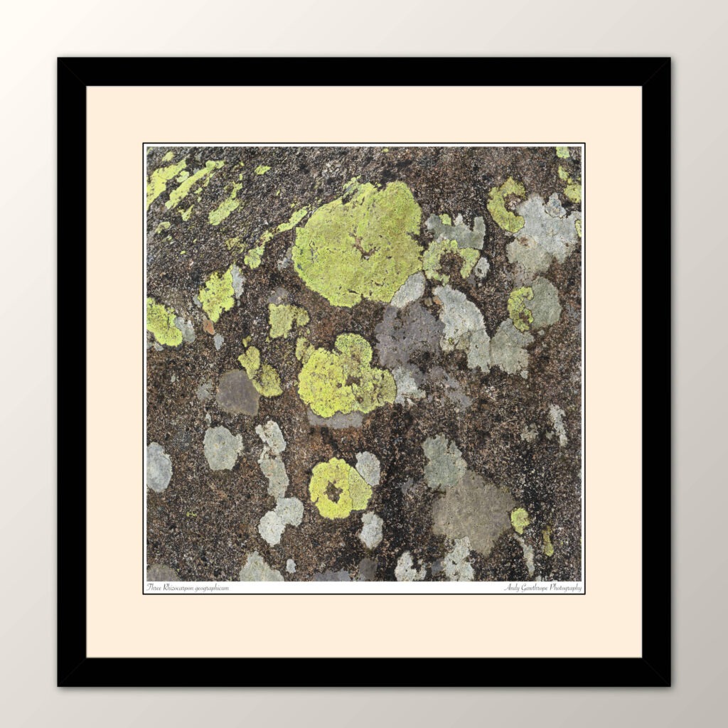
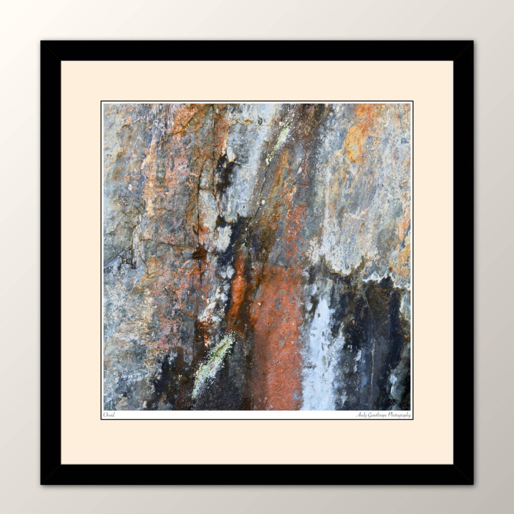
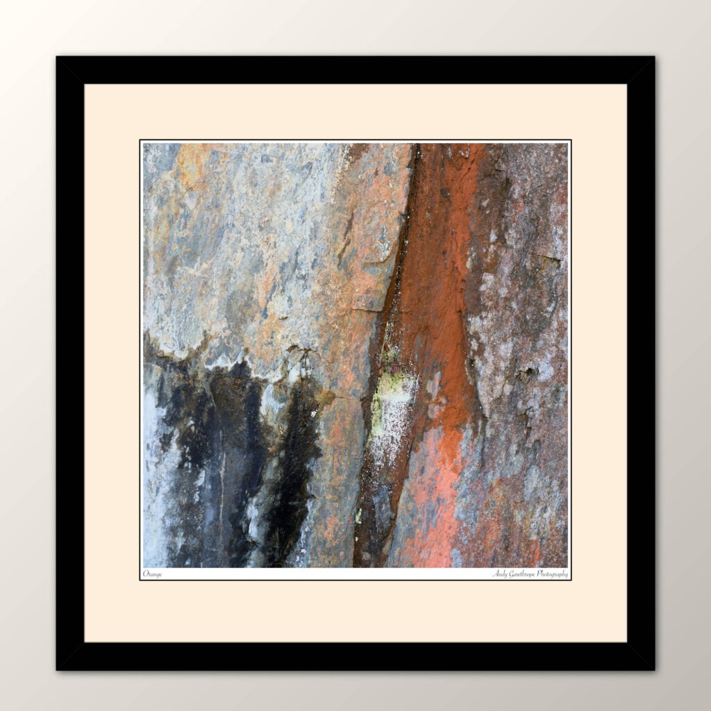
At the risk of upsetting many geologists, I suggest rock is commonly considered as dull and almost uniformly grey! What this project shows is that rock can be many different colours depending on its mineral composition and is certainly not a boring uniform grey! Some of my favourite images from the project are the parallel, vertical silver stripes. Not only are they a bold pattern but they are very simple with lots of detail and the square composition adds that little extra tension. I like the questions that come to mind. Just what are those stripes and where do they go? What am I looking at? I also like those with blocks of orange, pink, black and brown colours. Again I’m drawn to the images and forced to question what I see. These are the abstract images. With other images the subject is clear, such as the tiny green fern growing in a pocket on an otherwise clean, grey rock-wall. It’s so incongruous that I instantly knew it had to be in a photograph. For that and a few others, I felt context was important and chose to include a greater amount of rock.
Conclusion
This project deliberately constrained itself to a few places in Borrowdale so as to be manageable and not open-ended. But I’m of the mind that it could be extended to other area’s and could grow in coming years. Stylistically it’s been very different and a refreshing change.
Many of the photographs in this post will soon be available as individual prints or sets of prints on the Andy Gawthrope Photography website.
I do hope you’ve enjoyed reading this and seeing the images from the project. Please leave a comment below.
All images are copyright Andy Gawthrope Photography.
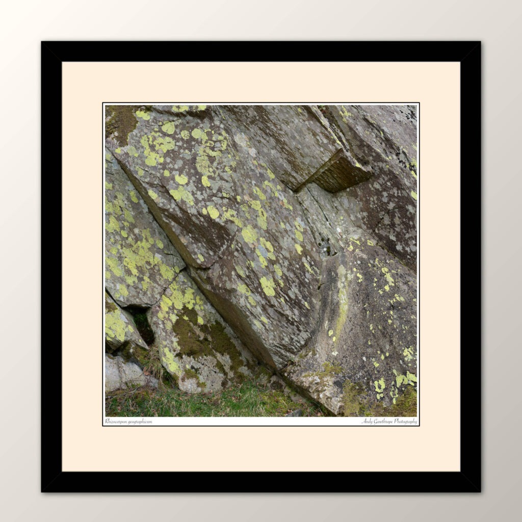
The colour of rockThe FernSilver stripes No. 2QuarryAlienBoltsSilver stripes No. 1FingersMossDry and WetThree Rhizocarpon geographicumRhizocarpon geographicumTriangleOvoidOrange
It was through poor choice and unlucky timing that I sat in Bristol airport departures awaiting an aircraft due to depart over two hours after its scheduled time. Poor choice because it was the start of the school holidays and thus busy with families and board children; unlucky timing as the French air traffic controllers were on strike. Headphones on, listening to Expeditionary Force, Book 4 by Craig Alanson time quickly passed tho. Tip: If you like your sci-fi saga’s – check it out…
In a car collected at Inverness airport it was about 1.5hrs drive to where I was staying. A small village with hotel, bar and shop – what more could you want – called Shieldaig in the North West Highlands near Torridon.
The roads in the North are quiet but especially so away from Inverness. Notable was the 15km of A896 winding its way below Beinn Eighe and Liathach as it’s single track and unlit. Being unfamiliar with the road, in darkness thanks to the delayed flight, with headlights that only seemed to illuminate the road just in front of the car and with the ever present risk of deer lurking on the road it was a demanding but thankfully uneventful drive. During the week I travelled the road several times and it became less scary but it certainly wouldn’t be a road on which to have an accident or breakdown during the night.
The North West Highlands are very special; It and its Northern neighbour, Assynt, are two of the few remaining truly wilderness landscapes in the UK. The area can be bleak and imposing but it most certainly always forces you to appraise your significance in the environment. They are a wonderful juxtaposition of craggy coastlines, turquoise waters and white sandy beaches with dark and imposing expanses of impenetrable moorland separated by large mountains and rivers. With a low human population it’s easy to feel small in such a vast natural environment. Beyond being stunningly beautiful, I find the Highlands relaxing, calming, almost spiritual – although I wouldn’t consider myself religious in any way. This is why I love to photograph the Highlands and why – note to self – I should visit more often.
I had originally thought of staying at The Torridon hotel as it was central to the area I planned to photograph; But a cheaper alternative, and where I stayed, was the Tigh an Eilean hotel in Shieldaig. This had the distinct advantage of being within walking distance of an area I planned to photograph. I’m happy to write that it was a great small hotel with friendly, welcoming staff and so I can recommend it to readers.
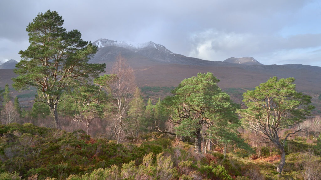
The prime objective for the trip was to make images to expand the selection of greeting cards in my Christmas card range. Here in the UK that means snow, although we seem to get precious little these days. Hence going mid-February, traditionally the coldest of the winter months and the most likely to have snow. During the drive-in on that first night it was too dark to see any snow on the mountains but there was none at road level for sure. My suspicion was confirmed the first morning. No snow; Only traces of white high on the mountains where snow lay in deep gullies. The area is on the North West coast so snow wasn’t guaranteed but I was hoping for some on the mountain tops at least. Time for another plan.
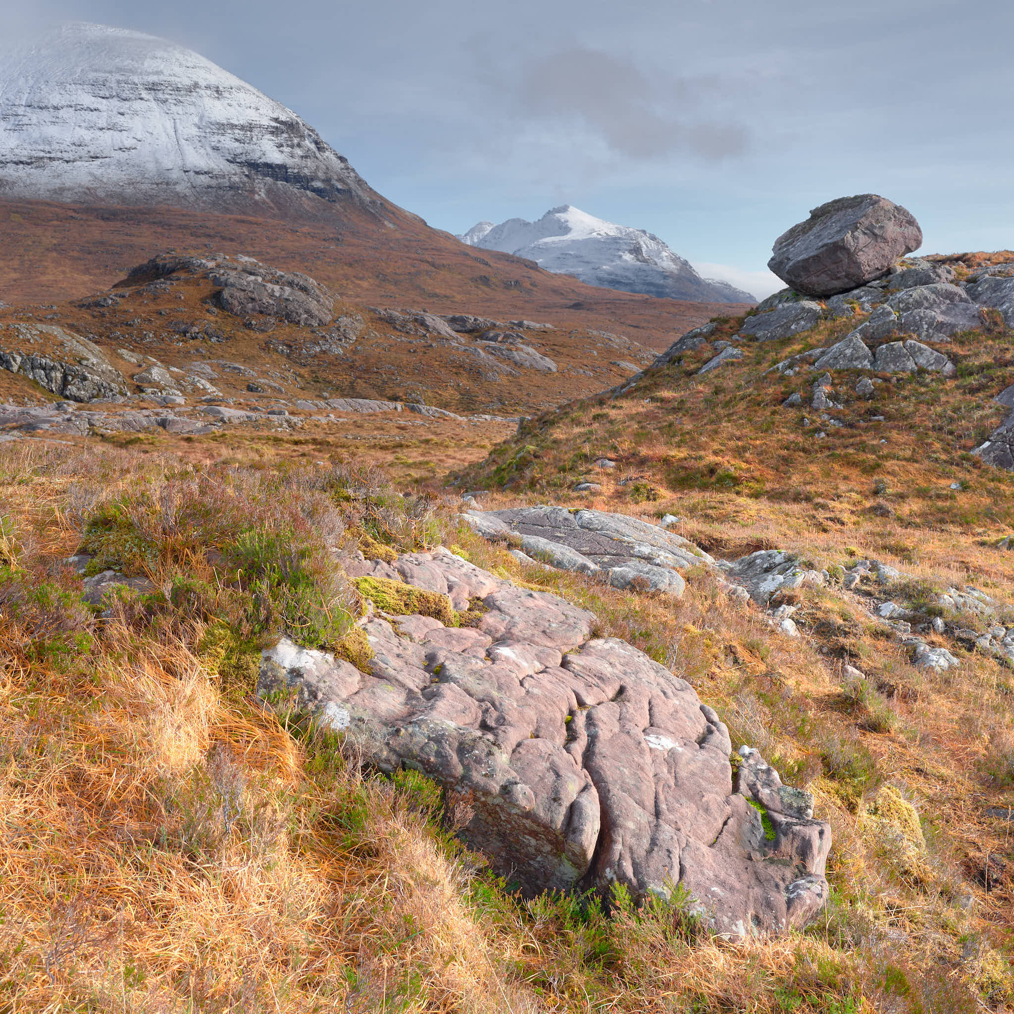
The fall-back plan was essentially the original plan but without snow and switching from cards to photographic prints. Unfortunately, cards will have to wait for another year. With the exception of the first day, the weather was forecast to be mostly cloudy, dull and wet for a few days followed by stormy weather, storm Otto a strong subject in photographs was important. There was a chance of snow late in the week, on the mountain tops at least. The plan was to concentrate on Scots Pine trees and an area just North of Alligin Shuas where glacial erratics lay on a hill with good views to the South.
The Erratics
Glacial boulders
The afternoon of the first day was spent in an area North of Alligin Shuas with the intention of identifying one or two compositions for late afternoon when a break in the cloud was forecast. Parking by the roadside was easy but I was immediately reminded how difficult boggy Scottish hillsides are to traverse but keeping to rocky areas, going was easier.
The area has many glacial erratics, some in precarious positions and which, some day, will surely roll. There were so many that I considered it a ‘target rich environment’; Numerous compositions are possible given the ‘right’ light. Light which I did have, momentarily, near sunset.
Being a hillside roughly 300m above the sea with no significant features to the West there is little to no protection from whatever weather comes off the sea. That afternoon was cold with a biting Westerly wind forcing the use of rocky outcrops and large boulders as shelter just to keep the camera stable. Even then I pushed the ISO just to keep an appropriate shutter speed. Whilst exploring the area it became clear that to make it work photographically, good light was especially important. I knew further visits would be necessary.
What I really liked about the area was the staggeringly beautiful views to the South across Upper Loch Torridon to Loch Damh and the Ben Damh Forest. Although 300m is not high, the area feels much higher and it’s almost unimaginable to think that glaciers once covered the area. Now that, I would like to photograph!
A second visit was equally as cold but a little less windy; But there was a little snow on the high mountains. This time I spent the morning exploring the area to the East of the road finding more erratics and a composition which I think is my best one from the entire trip. After returning to the car to warm-up and a bite to eat, the afternoon was spent exploring the West side again.
By late afternoon thin cloud covered the sky providing a very soft milky-white light not sufficient to reveal the shapes and textures of the ground. Half my brain was saying you are cold, tired and with these clouds there isn’t going to be any light at sunset. The other half was saying, you are here now and are not going anywhere until that sun has set! I’m sure all landscape photographers know those mental shenanigans! Happily I stayed put and right on-cue the skies cleared just as the sun set. The half that said ‘stay put’ was now saying ‘I told you so’!
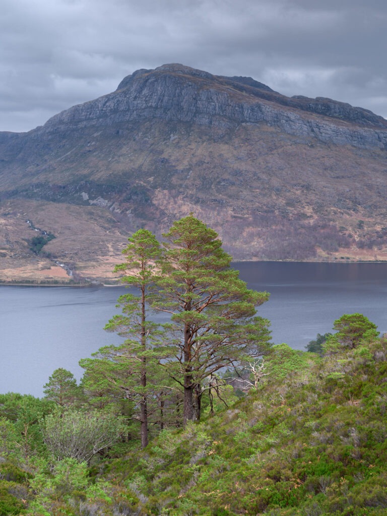
Upper Loch Torridon, Loch Damh and the Ben Damh Forest
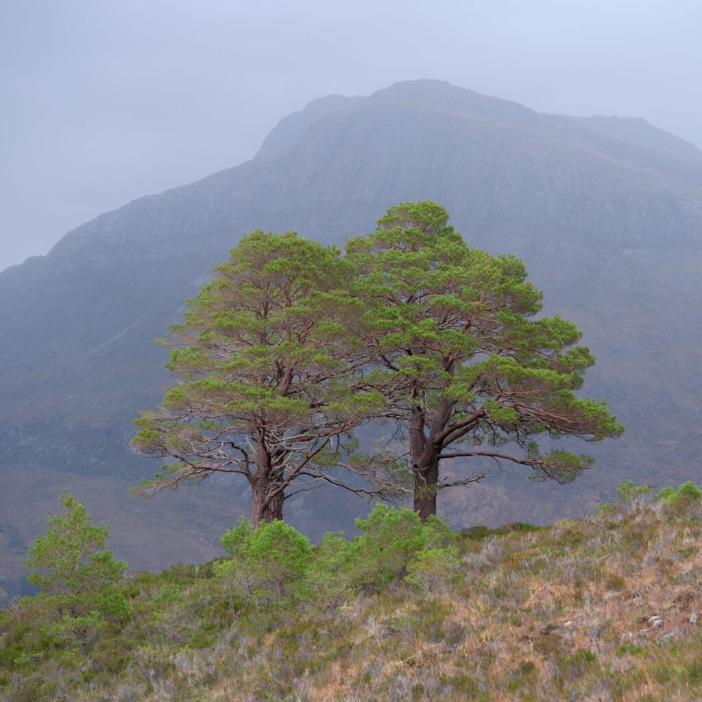
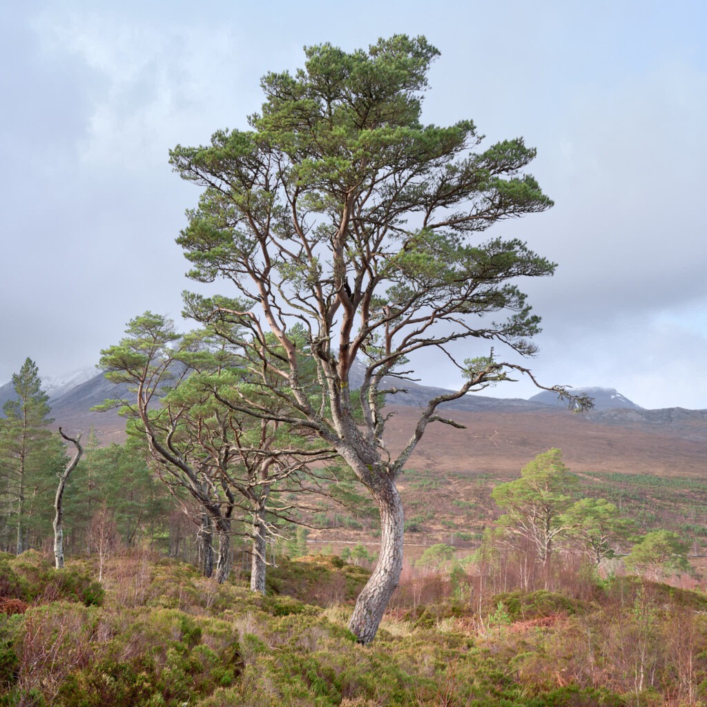
Scots Pine
The Scots Pine, Pinus sylvestris, is a fantastic tree, their trunks can have some great shapes and they have the most amazing greens and reds all year-round not to mention the landscape in which they grow. It’s those characteristics that attract me. They seem so right, so at home in the Highland landscape.
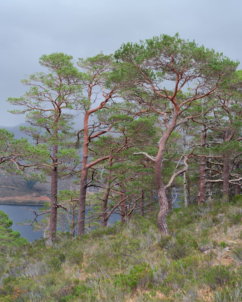
Two Caledonian Pine
The light at the very start and the very end of the trip was good but other days were mostly dull with thick grey clouds and, on some days, frequent rain showers. Being on an exposed hillside getting wet and cold didn’t sound like fun so, on such days, I explored woodland/forests in search of Scots pine compositions. This had a couple of advantages: shelter from the weather and stronger compositions, compositions better suited to the conditions.
After poring over Ordnance Survey maps the West of Loch Maree looked interesting. Following a Beinn Eighe path the woodland was dense and way too compositionally complex. Knowing that eventually I’d reach a level were the woodland stopped and the mountains began I kept ascending. Sure enough at the upper edge of the woods were widely separated Scotch pines on grassy/heather-covered slopes with Loch Maree and distant hills in the background. Not that the backgrounds were that visible through the rain! But the rain, like fog, added separation between the subject and background plus a little atmosphere. Sometimes a little too literally for my liking! The hillside faces North East with big mountains to the South West so the best light would probably be during the morning or possibly evening if the setting sun lit clouds overhead; But with thick cloud overhead the light was very diffuse.
Ben Shieldaig woods
Woodland on the side of Ben Shieldaig was an absolute must being so close to the hotel and thus within easy walk. But what was the best way of enter the woodland? Locals suggested the track on the Northern end, the Shieldaig end. Suffice to say I didn’t return that way, instead exiting just to the South of the Applecross road junction opposite Loch Dughaill then walking back to the hotel along the road. Surrounding the woodland are tall deer fences but fortunately there are gates through which access can be gained. They are widely separated tho and are not marked on maps so some exploration is needed to locate them.
The woods are on the Western side of the 516m high Ben Shieldaig. Most of the hill has steep sides but there are a few more level area’s opposite Loch Dughaill which can be reached on foot. Finding compositions that minimised the complexity of surrounding trees and vegetation was difficult, especially given the available flat light. I feel it’s a location with potential but that it needs a significant investment to identify compositions and have appropriate light.
Windy, Torridon
On a wet and windy afternoon in the wake of Storm Otto I explored the track that follows Abhainn Coire Mhic Nòbuil through woods above Upper Loch Torridon. Only one successful image, that to the left, was made but the curvy tree, its leaves and the flat light evoke the conditions nicely.
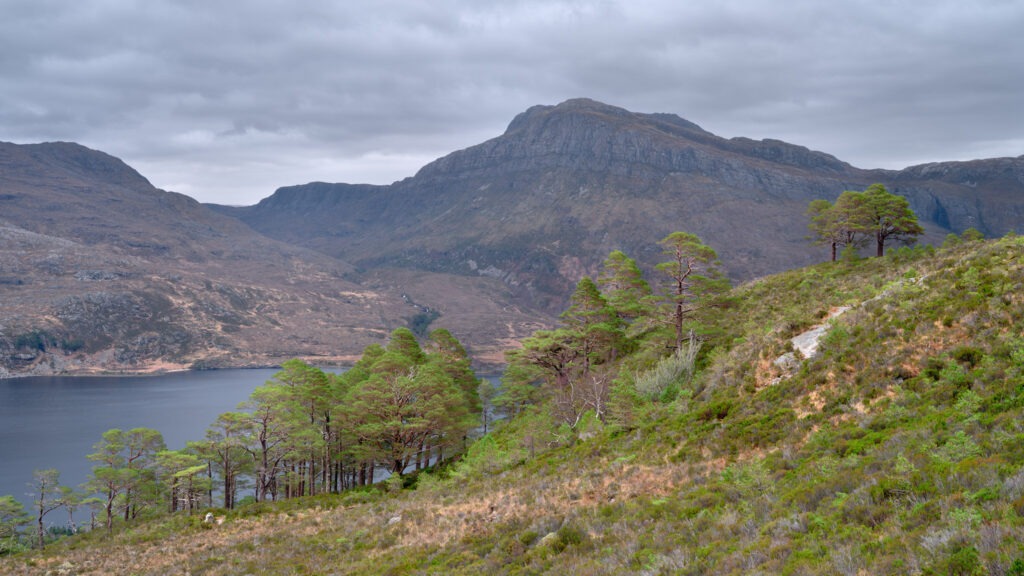
The area to the South of the A’Ghairbhe river near Kinlochewe has many fine looking Scots pines. At first sight the area looked hard to access but closer inspection identified it to be straightforward with simple parking and access to the woodland; although off the forestry tracks it was much harder underfoot thanks to the rain. What I liked about the area were the wonderful pine trees and the opportunity to place the Beinn Eighe range in the background. Whilst there I was fortunate that the clouds broke for a short while bathing the woodland in bright, directional light.
Spidean Coire nan Clach
Conclusion
Overall the week was quite challenging due to the weather and light and some nice photographs were made. The choice of hotel was a success as were the travel choices of flying and car hire. Would I go back again. Absolutely!
Andy
All images are copyright Andy Gawthrope Photography.
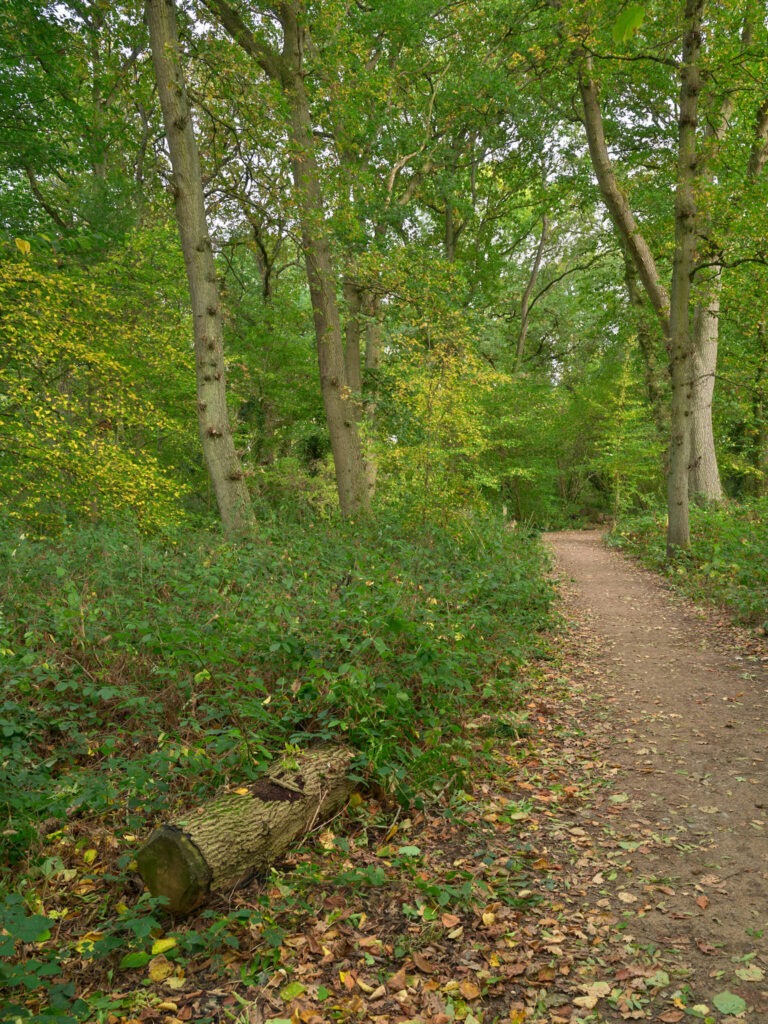
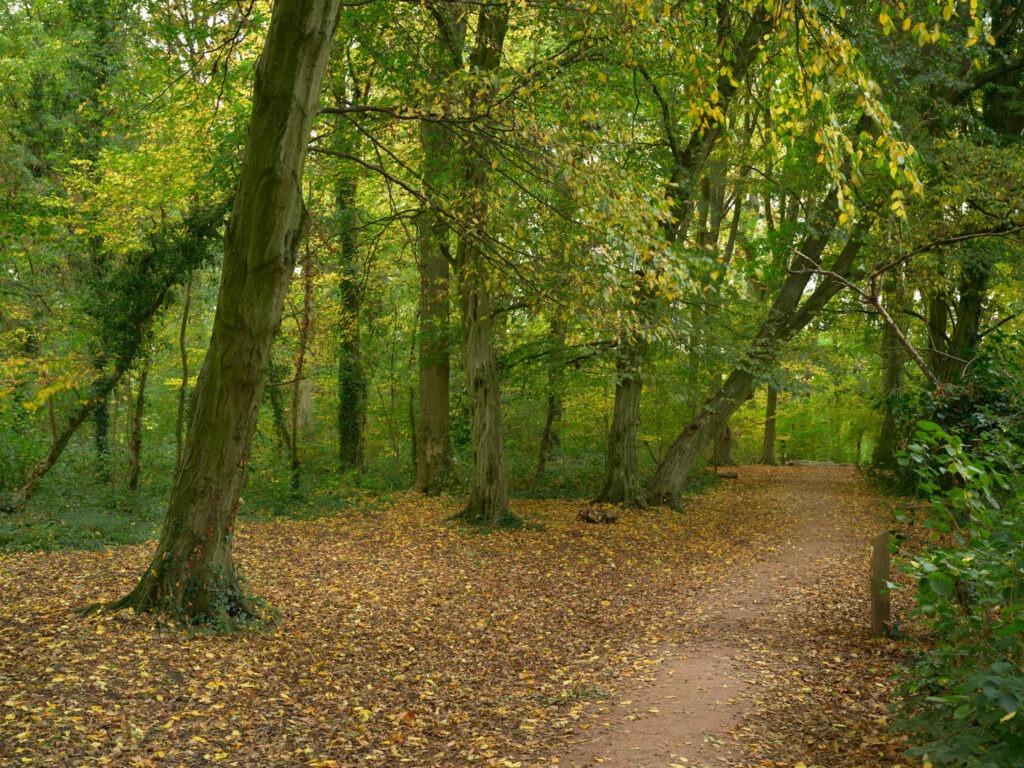
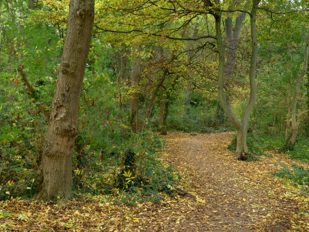
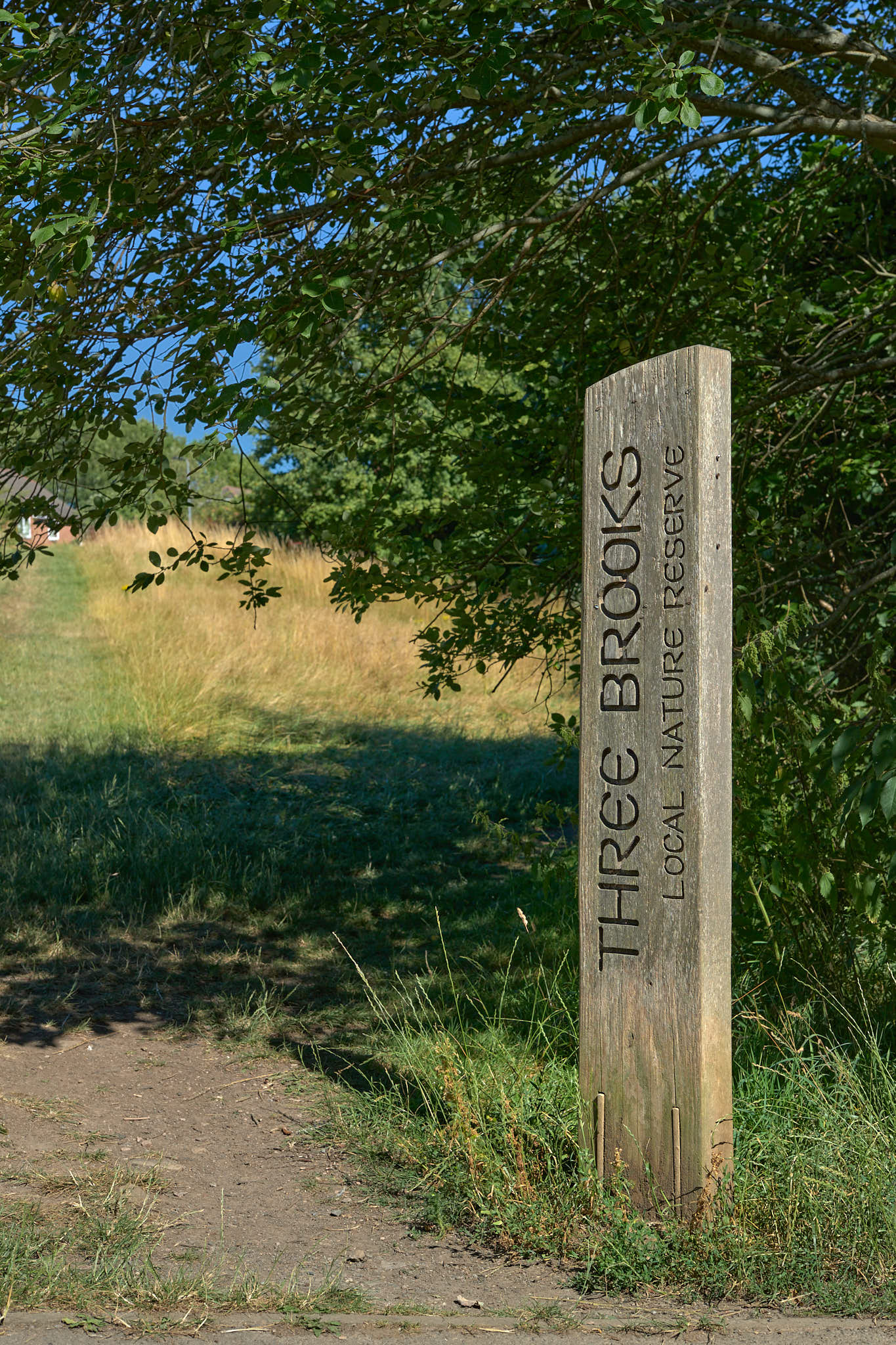
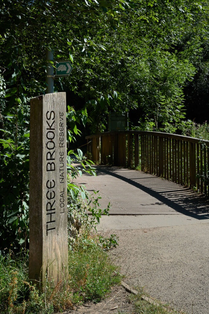
As readers of my previous post will know, Savages Wood is a small woodland in the Three Brooks Nature Reserve. It’s my closest woodland and I spent a little time walking its numerous paths amongst trips to more extensive but distant woodland and forests this Autumn.
First a little lesson. Healthy tree leaves produce a substance called chlorophyll; chlorophyll absorbs all but green light hence leaves typically appear green! But, when the chlorophyll content reduces other colours, especially yellows, become visible. This reduction in chlorophyll occurs when the amount of sunlight reduces and temperatures start to decline. We know this time as Autumn.
The main factors contributing to the intensity of non-green colours are the tree species, the temperature over time profile, the amount of light and the moisture content of the soil. With so many factors it’s not surprising that the same tree can look very different from year to year! These factors also highlight why, for example, trees in Northern England generally change colour and drop their leaves before trees in Southern England or why the change may appear as several waves over a few weeks.
Anyway, lesson over. Autumn in Savages Wood appeared to peak during the third-week of October and pretty much to schedule – perhaps early by a week or two at most. Considering the dry and at times very hot weather that shouldn’t have been a surprise but through September and early October I did feel somewhat unclear what Autumn would look like and when it would occur this year.
The walking of dogs is very popular and based on my experience it’s probably what brings most people into the wood. Making photographs with a large camera and tripod takes time and the process is very different to taking quick snaps. So, it was a pleasure to meet and say ‘hello’ to some lovely dogs and their owners who passed by once, twice or more times whilst I was waiting on the light to change and/or the wind to drop.
Below are a few photographs of Savages Wood this Autumn. For those that know the woodland well you may spot that whilst developing I’ve removed the graffiti from the tree I call the ‘Tuning fork’. Unfortunelty, this was only possible on the photograph!
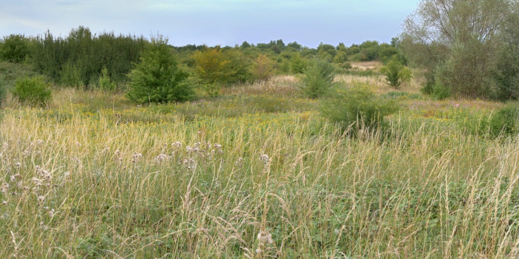
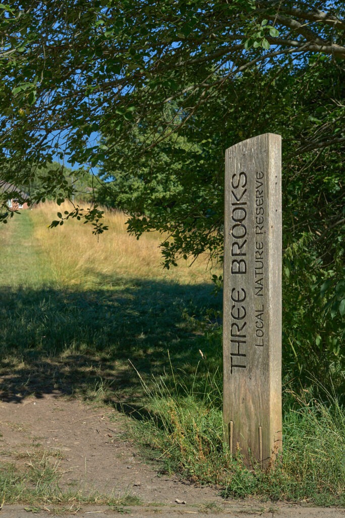
The Three Brooks Nature Reserve is the gem of Bradley Stoke. At 110 acres (roughly 62 football pitches) it provides a biologically diverse, green space for the community. The history of the reserve may be less well-known and I for one originally assumed it was contemporary with the 1980’s commencement of home building. Whilst that’s true, the reserve does enclose areas with much longer histories.
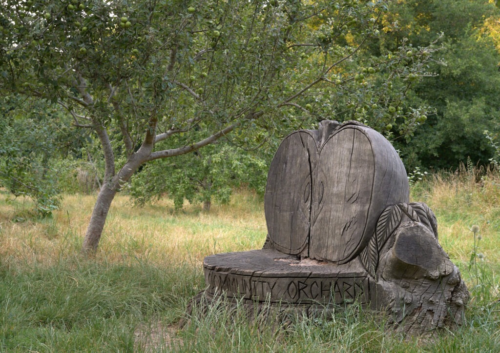
Is three the magic number? As its name suggests the reserve includes three brooks – Patchway Brook, Bradley Brook and Stoke Brook – but also three woods: Webb’s Wood, Savage’s Wood and Sherborne’s Brake. The name Four Brooks Nature Reserve is, perhaps, more appropriate though as the Southern end of what is today Patchway Brook was once called Hortham Brook. In 2007 a small Community Orchard was also planted; located in the heart of the reserve and just to the East of Bradley Stoke Community School. So, technically, the magic number is four!
Webb’s Wood is on the North side of Stoke Brook near the lake and is probably the oldest wood within the reserve. Sherbourne’s Brake sits at the South Western edge of the reserve near the junction between Braydon Avenue, Brook Way and Orpheus Avenue and is considered to be roughly 200 years old. Today Savage’s Wood covers the largest area, contains a small pond and the tallest trees.
The National Library of Scotland has an excellent website that allows maps from different times to be overlaid and their transparency adjusted to enable easy comparison. Comparing a modern map against, for example, the an Ordnance Survey Six inch map from 1888 – 1913 identifies just how much has changed and, very surprisingly, how much has remained the same with many old field boundaries still delineating either housing developments or modern roads. Be warned tho. Comparing current-day features with a previous era is a wonderfully engrossing journey into history!
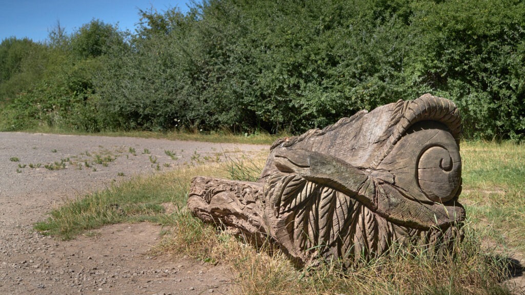
Apple bench
As a UK landscape/nature photographer who has lived in Bradley Stoke for 20+ years the reserve provides me with a local space that is easily accessible were I can relax, exercise and just be outdoors. Certainly, during the last couple of years and the various pandemic restrictions its been a great resource which I know is appreciated by many more in the community than it was prior to 2020. Sometime in the summer of 2020 I recall speaking to someone who confessed, that although she knew the lake and reserve existed, she had never before visited. Perhaps that’s a benefit of the pandemic, we were all forced to explore our local communities a little more.
The Tump
One of my favourite parts of the reserve is the Tump. It’s a man-made hill created from the spoil of the second Severn crossing, now known as The Prince of Wales bridge. From the surrounding area it’s an unassuming little hillock, something you hardly notice but climb to the top and you get some great and quite different views across Bradley Stoke and Gloucestershire over to the Southern edge of the Cotswolds. A little height makes a big difference!
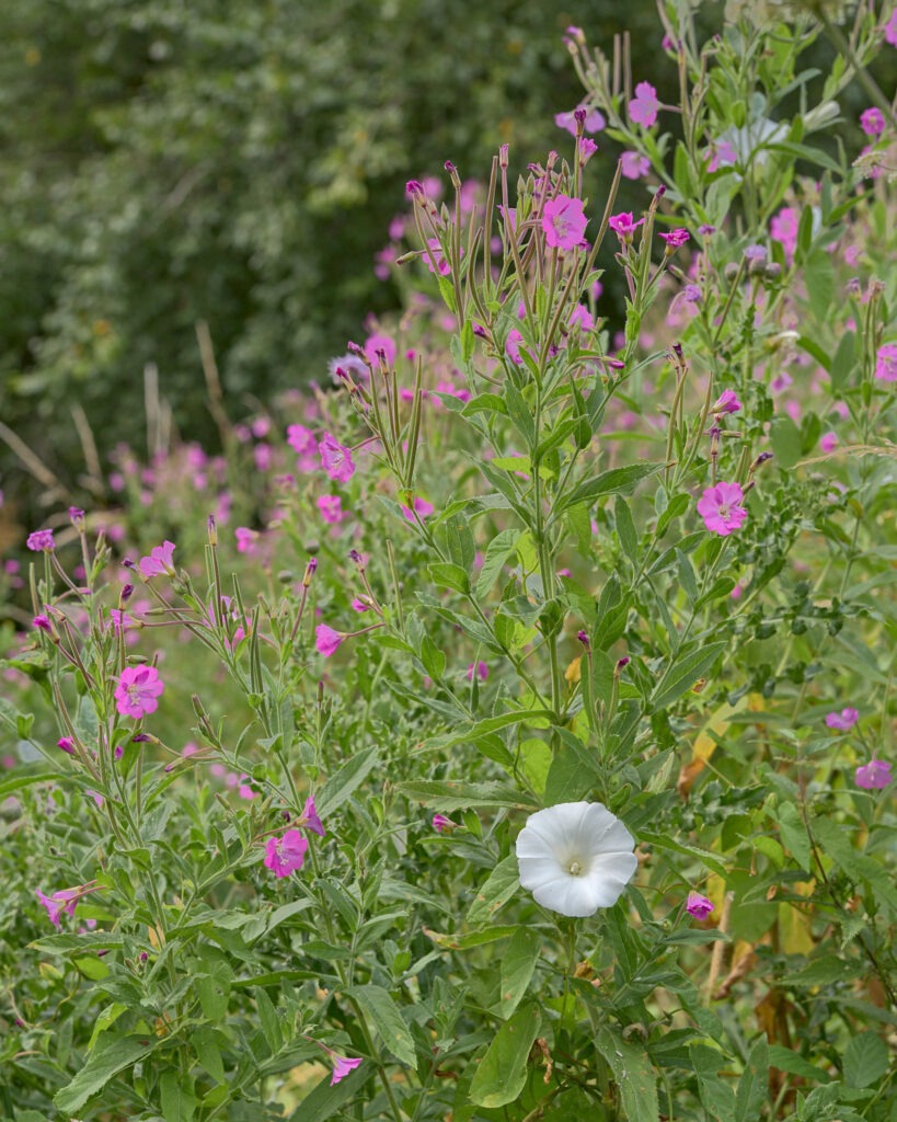
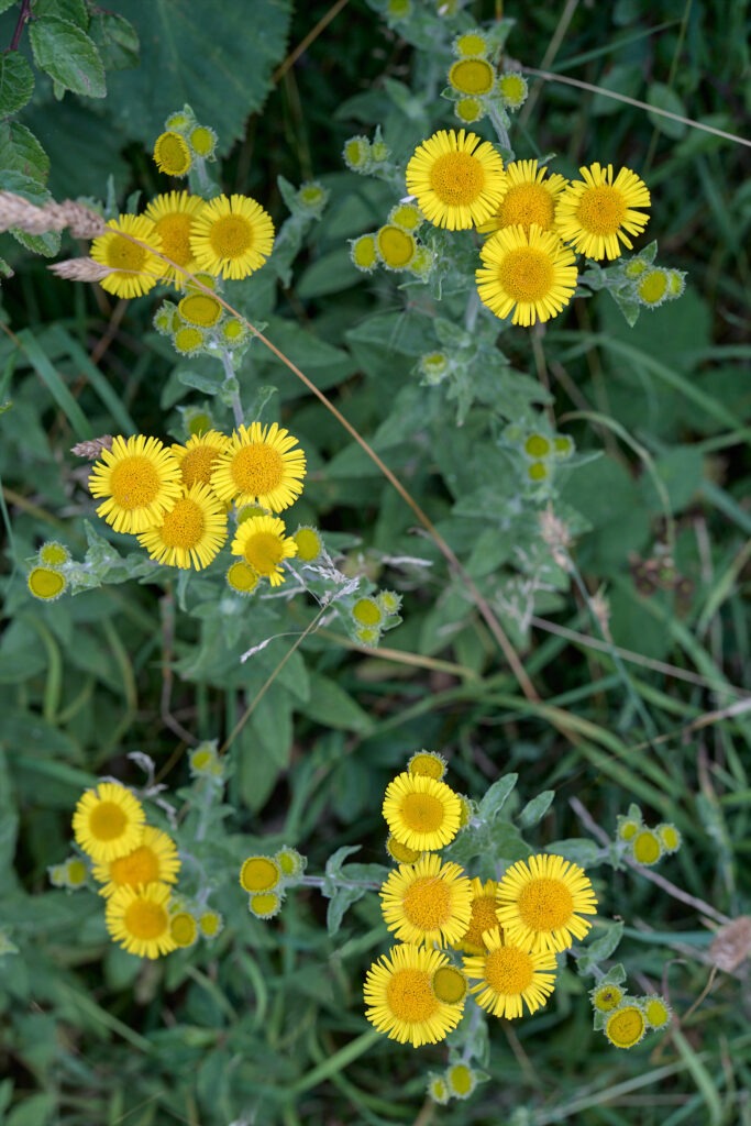
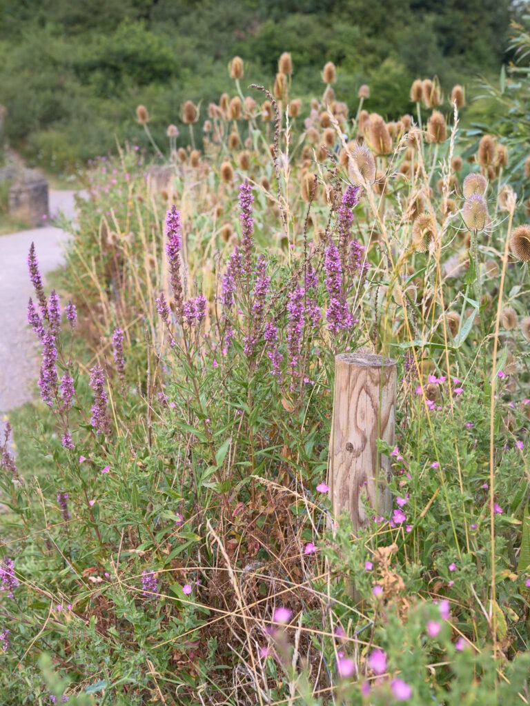
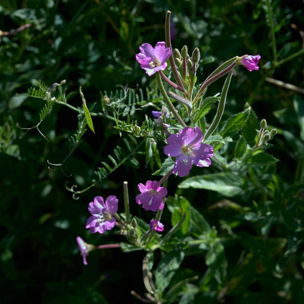
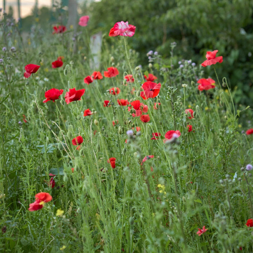
Walking on the Tump is always interesting. In places, due to weather and human activity its surface is gradually eroding and, as it does, objects are starting to surface. I’ve certainly noticed a small vehicle tyre emerging from the ground a little more as each year passes and there are also items I don’t quite yet recognise! There is something that looks like the top – perhaps a rocker cover – of an engine as well as more identifiable objects such as stone piping and bricks. Please don’t get the impression it looks like a rubbish tip tho; it has been left alone and its top is now a grassland home to wildlife comprising a few trees and lots of wild flowers – Red Campion, Wood Anemone and Ragwort to name a few.
White flower
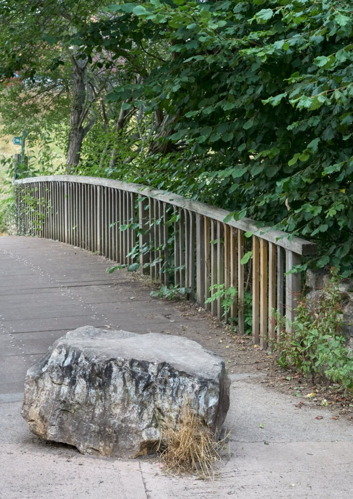
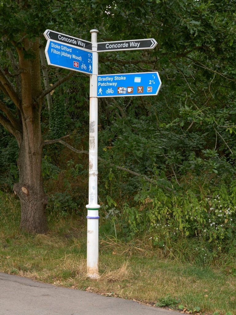
In addition to the main path on its Western side, there is a small path from its North-East corner. This path winds its way North through the woods between the M4 motorway and Patchway Brook passing the junction with Hortham Brook before finally emerging at the stone bridge crossing Patchway Brook. It’s a less trodden and probably lesser known path but a great path nonetheless as it provides a wonderful alternative to the well-trodden, motorway that is the main stoney path to its West.
Webb’s Wood is another of my favourite spots; perhaps because the bluebells were in full-swing when I first visited, perhaps because its so easily missed when passing along the well-worn track to/from the lake. On casual glance it appears to be no more than a few trees by the side of Stoke Brook but force yourself off the track and into the wood and you’ll discover a really pretty little wood with some of the best bluebells in the reserve. Continue through the wood to it’s East-side and you find a hidden, almost secret little clearing.
Looking after our reserve is the Three Brooks Nature Conservation Group and their working-parties are sometimes seen managing the reserve. If you would like to assist I’m sure they would be grateful. See links below.
I’ve illustrated this article with photographs captured during the last few years in the reserve. The image grid below contains the images used above plus others which didn’t fit within the text. Click on images to see the full-size version. To see my photographic work from around the UK please visit Andy Gawthrope Photography.
Andy
All images are Copyright Andy Gawthrope Photography.
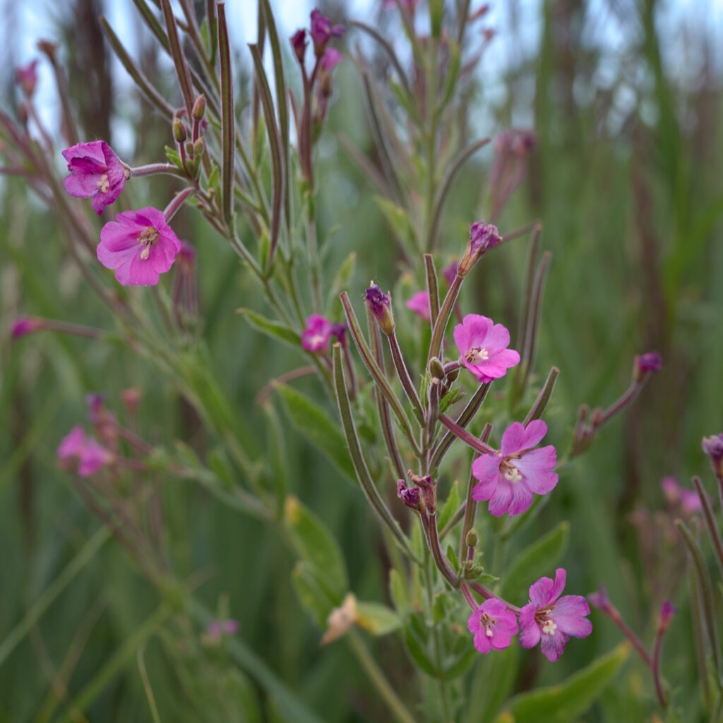
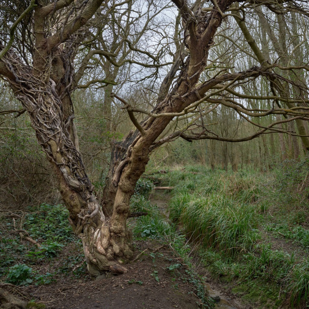
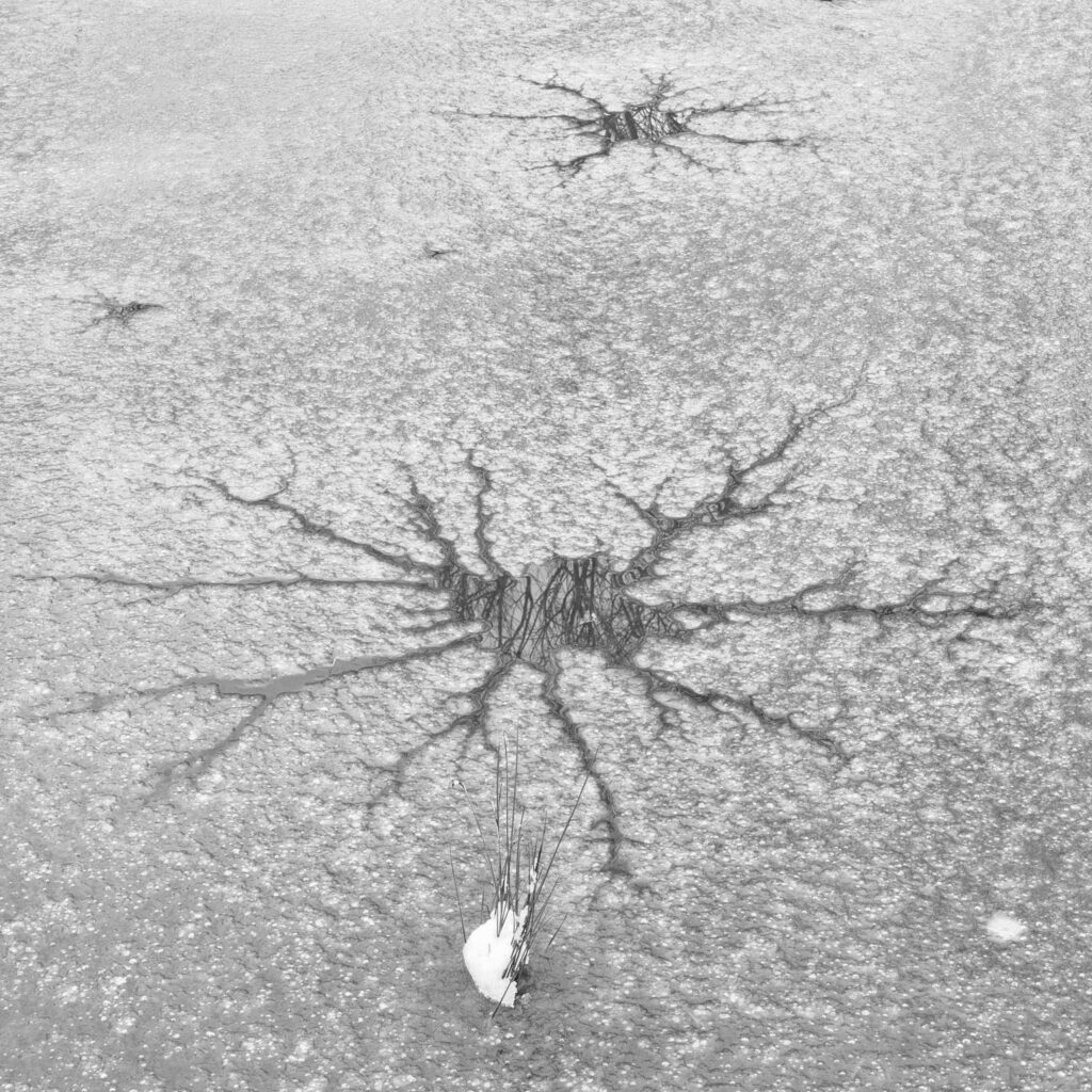
Three Brooks signageThree Brooks signageYellow flowersFoot bridgeCracksWhite flowerHedgeConcorde Way signageWinter at the pondPurple flowersPurple flowersPoppiesSpooky treeIceWinter in Savages WoodApple benchSnail benchThe Tump
It’s hard to convey the feelings of peace and tranquility experienced when stood quietly and still in woodland under a canopy of trees on a windless day. The only sound to break silence is that of squirrels busily preparing for Winter. Initially they scurry to cover but after a few minutes return to their activities. It a beautiful and calming feeling.
There were days this Autumn when I saw no-one else all day, not even the usual dog walkers. Sometimes I just stood there surrounded by trees absorbing the beauty of nature. Even photography was pushed to second place – and that takes some doing!
I had hoped for some misty/foggy mornings to bring a little mystery, emotion and separation to the woodland but it wasn’t to happen for me this year. The weather has been very warm and as I write this in mid-November its still 13 degrees Celsius outside. Autumn this year has been a slow ‘burn’; it’s not over yet although leaves are now dropping rapidly. Another week and the show will be over for another year.
The photograph above was made with the Medium Format camera and the one below entitled ‘The Lost Wall’ with the Full Frame EOS 5DSr. These were taken 9 days apart and very clearly record the progression of Autumn. Unfortunately I wasn’t able to match the focal length of the lens so the latter used a slightly longer (50mm) lens. The Medium Format image used a 48mm (approx 39mm equivalent) lens. This change in camera was due to a problem with the Medium Format lens which is now being repaired.
Peeking through the trees
‘Peeking Through the Woods’ was made through a gap in the trees with a long lens. The distant trees were set slightly back from the main canopy and were just catching a little late afternoon light that penetrated thinner cloud. It was just enough to lift the yellows and reds and give the appearance of a halo surrounding the tree. It looked wonderful 🙂 I particularly liked the lighter coloured tree in the background that leans to the left – it added depth and character to the photograph. The tree on the far left is compositionally interesting; my initial thought was to remove it as it was too dominant, however, this wasn’t possible without upsetting the balance of the photograph. So it was included with the intention to remove it in post production. In post production, however, the tighter crop necessary to remove it from the frame upset the balance and, actually, I decided I quite liked it! Try covering it with your hand – the photograph isn’t as strong; it seems to act as an anchor and helps with a sense of depth.
I’d love to hear what you think about these posts and the photographs so, please leave a comment below.
Andy
All images are copyright Andy Gawthrope Photography.
Select an image from the gallery to enlarge.
Lost wall. No. 1Lost wall. No. 2TreesDeep in the woodsPeeking through the trees
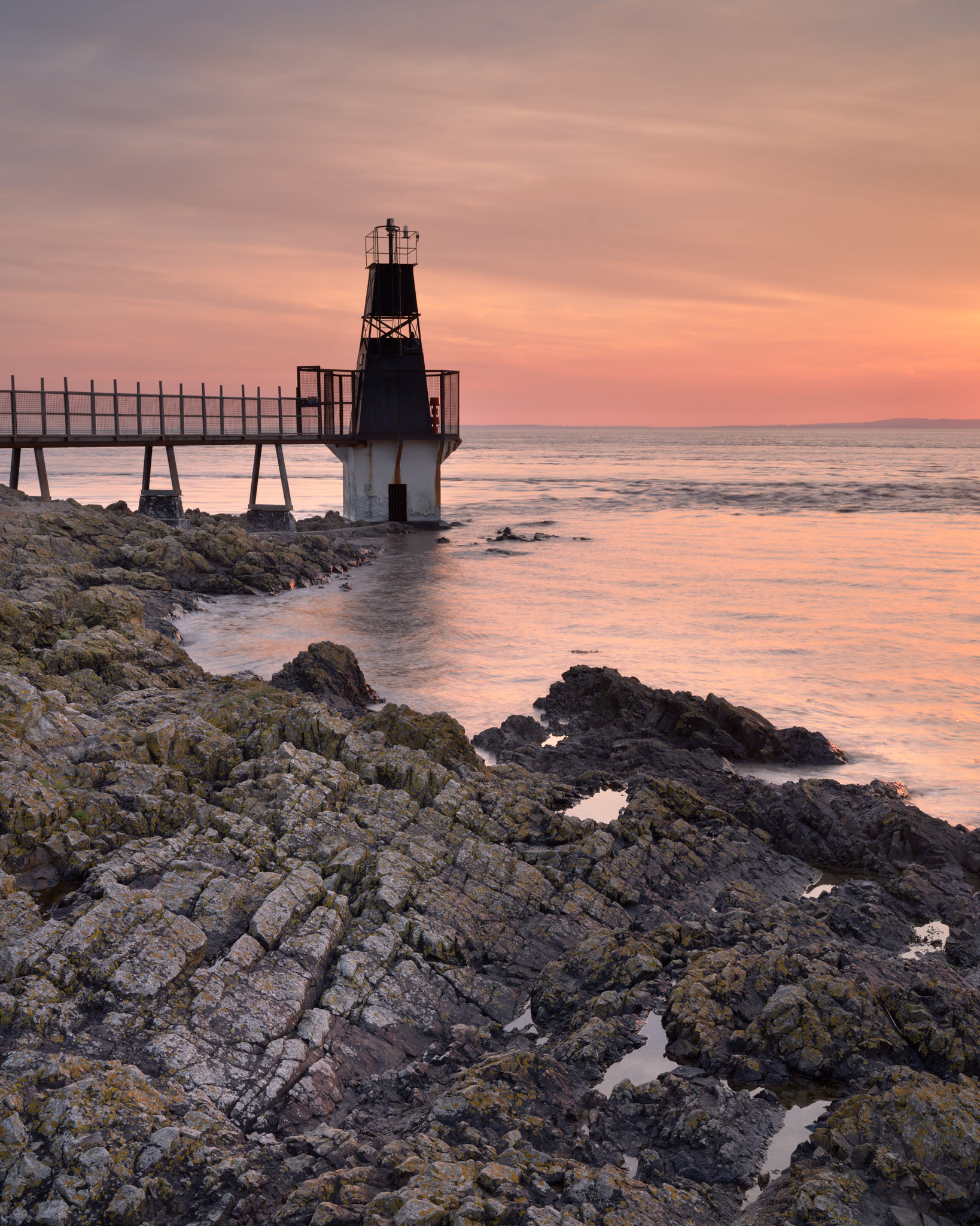
Battery Point at Portishead is one of those places I’ve known about for years but never actually photographed as its so close to home. Partly due to Covid travel restrictions I made it a bit of a mission recently.
For those not familiar; Portishead, not to be confused with the 90’s/naughties music band – of whom I’m a great fan :-), sits on the coast just South of the entrance to the Avonmouth / Bristol docks. Battery Point is a channel / navigation marker for the ships, which are pretty large, entering and departing the docks. As the tidal range is large the sea height can vary from well below or totally surrounding its lower parts.
As any landscape photographer will know, a good photograph often requires many visits to a location before light and conditions align with the minds eye. The photograph above is no exception; I’d been at least five times previously, coming away with ok images but not what I was looking for. On this particular occasion I very nearly didn’t visit as the clouds looked a little heavy at home and I thought the tide may be a little high. But I did go and conditions were just about perfect! Persistence, pays 🙂
But there is more at Portishead than just Battery Point and I’ve now got a couple of other ideas on the go. I’m now waiting for the gods to smile again.
It’s been a strange year. Covid-19 Lock-downs didn’t really come to an end until July by which time the great clouds and light associated with Winter and Spring had passed. Summer is not my favourite season and not the favourite season of many landscape photographers due to the often harsh light, the ridiculously early starts and the late finishes necessary to capture the early/late light. But summer has now passed and Autumn with its shorter days is very much here. Trees are loosing their green’s and starting to reveal their yellow. As it’s been a dry year we may not get the orange colours that sometimes follow but the next few weeks will tell. Fingers crossed!
The Wiltshire Downs are known for their white horses; not the living, breathing type but those carved into the chalky hillsides. One of the famous horses is near Uffington on White Horse Hill. The horse is carved high on a hillside and is best photographed from the air. What drew me to the location one July evening was the feature called The Manger just below the horse. It’s a steep sided, elongated valley that cuts into the chalky hillside. In days past the hillside was the location of a Cheese rolling competition something that possibly still only continues at Coopers Hill in Gloucestershire.
Leaving home there was a little high-level cloud that could have made a nice sunset, however, The Manger is just over an hour’s drive East and inland from Bristol where the weather can often be different. It was on this occasion; clear blue skies with distant cloud towards the horizon and a light breeze moving the grasses. Not what I hoped for! Not awful though!
This was one of the early outings this year with the new Fujifilm GFX100S. Using greater than ISO 400 on my previous landscape camera would have resulted in significant noise, however, the GFX100S is a monster. The above photograph was made at ISO 1250 and has little noise. Its Dynamic range is also significantly wider making this high contrast image possible with a single exposure.
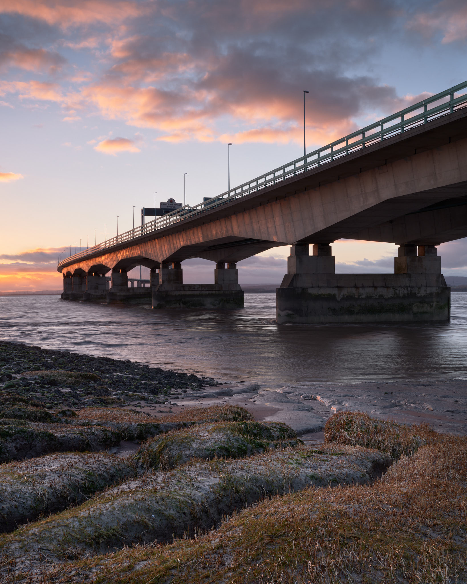
A quick check of tides and a peek out the window identified yesterday as a great evening to be at my favourite local location. Yes, you got it, full-marks; its the Prince of Wales bridge aka the Second Severn Crossing.
In an age where image manipulation is so prevalent the statement ‘A photograph never lies’ has, unfortunetly, lost its meaning. But whilst this photograph is pretty much how it was, I can tell you that those nice warm colours lie! They really don’t convey how cold it felt! The air temperature was about 7 Celsius with a gusty 20MPH wind coming from the direction of the sun. So, actually it felt about 3 to 4 Celsius!
Yesterday I was reading about ‘skills fade’ in ‘Summit’ the magazine of the British Mountaineering Council. The message was that climbers/mountaineers shouldn’t just assume they are as skilled in their sport as they were prior to the coronavirus lockdowns. Basically, their skills are likely to have got ‘rusty’ or faded through lack of use. Having fumbled-about making this photograph I can absolutely confirm I’m suffering from a photographic skills fade! There were times when I felt like a complete noob! Skills that seem to have faded are ‘seeing’ – that ability to compose photographs in the mind – and just basic workflow stuff. Stuff that used to be second-nature; stuff I wasn’t even aware I was doing. I’m sure those skills will grow again but it was a bit depressing. Despite that I’m pretty happy with the result 🙂
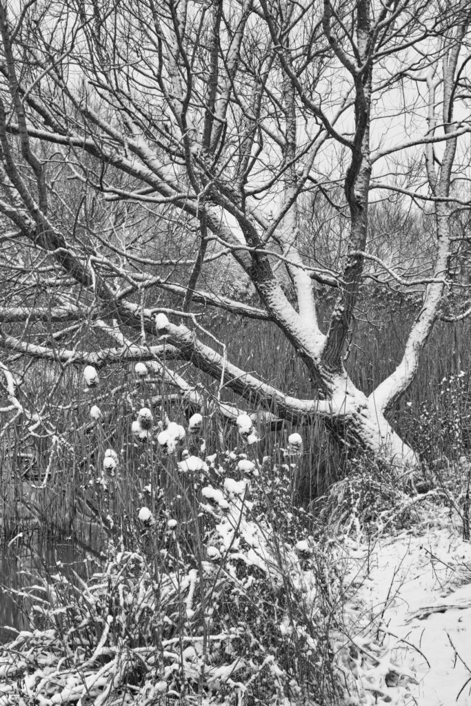
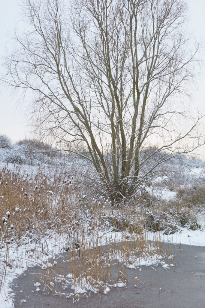
It’s not often it snows at home and thanks to the COVID-19 pandemic we currently are not allow to travel outside our local area here in England. In more normal times I would have travelled to other, more interesting, locations such as Dartmoor. But, this opportunity couldn’t be ignored so, my local woodland area was what it had to be.
There is a lot to be said for local photography especially in Winter. The sun doesn’t rise until 0800hrs and its quick and easy to roll out of bed, breakfast and arrive on-location in plenty of time. I arrived at my first location, before sunrise and, importantly, before anyone else came to see and play in the fresh snow. 🙂
Beneth some trees was a small patch of ice containing shapes which immedietly made me think: virus. Sad that it was the first thought that crossed my mind, but I guess, given the pandemic is shouldn’t have been a surprise. I could imagine them silently multiplying until they had consumed the ice like tiny preditors. The largest one seemed poised to devour a little patch of grass and snow near the base of the photograph.
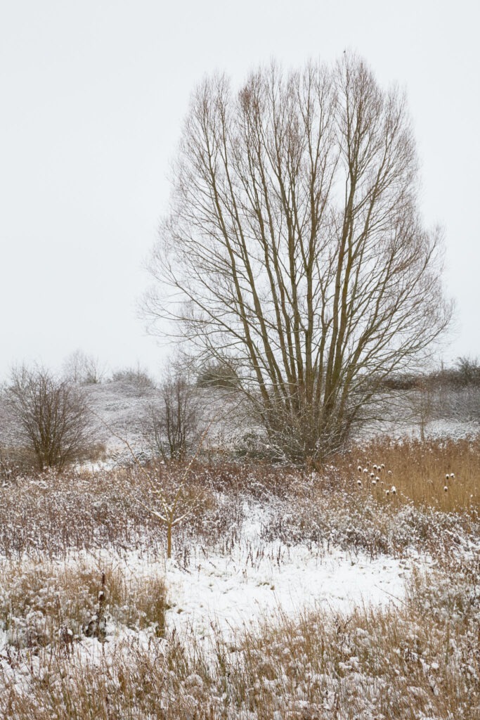
Three hours later and the snow was well trodden, sledged and melting fast. But I had managed to get out and make some nice photographs. My favourites are below. Click on them to enlarge.
Andy
All images are Copyright Andy Gawthrope Photography.
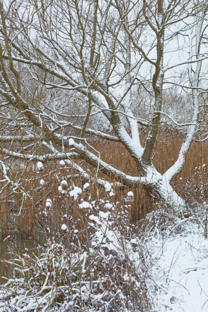
Winter at the pondTree over the pondTree on the TumpIce and TreeIce